Tolleson, Arizona
Tolleson | |
|---|---|
 Mural in Tolleson | |
 Seal | |
| Motto(s): "Honoring Our Past, Positioning Our Future"[1] | |
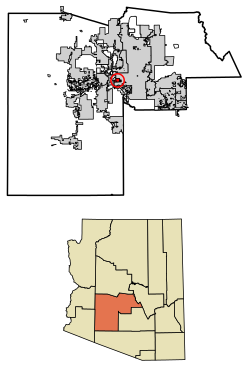 Location of Tolleson in Maricopa County, Arizona | |
 Tolleson Location in the United States | |
| Coordinates: 33°27′00″N 112°15′34″W / 33.45000°N 112.25944°WCoordinates: 33°27′00″N 112°15′34″W / 33.45000°N 112.25944°W[2] | |
| Country | United States |
| State | Arizona |
| County | Maricopa |
| Government | |
| • Type | City council |
| • Mayor | Juan F. Rodriguez |
| Area | |
| • Total | 5.73 sq mi (14.85 km2) |
| • Land | 5.73 sq mi (14.85 km2) |
| • Water | 0.00 sq mi (0.00 km2) |
| Elevation | 1,014 ft (309 m) |
| Population | |
| • Total | 6,545 |
| • Estimate (2019)[3] | 7,372 |
| • Density | 1,285.89/sq mi (496.44/km2) |
| Time zone | UTC-7 (MST (no DST)) |
| ZIP code | 85353 |
| Area code(s) | 623 |
| FIPS code | 04-74190 |
| Website | City of Tolleson |


Tolleson /ˈtɒlɪsən/ is a city in Maricopa County, Arizona, United States. According to the U.S. Census Bureau, the population of the city was 6,545 as of the 2010 Census.
History[]
The city was incorporated in 1929,[6] and named after founder W.G. Tolleson.[7]
Geography[]
Tolleson is located on the western side of the Phoenix metropolitan area. The community lies just south of I-10. The community of Avondale lies approximately four miles to the southwest and is four miles to the southeast. The Agua Fria River is about four miles to the west.[8]
According to the United States Census Bureau, the city has a total area of 5.6 square miles (15 km2), all land.
Demographics[]
| Historical population | |||
|---|---|---|---|
| Census | Pop. | %± | |
| 1930 | 910 | — | |
| 1940 | 1,731 | 90.2% | |
| 1950 | 3,042 | 75.7% | |
| 1960 | 3,886 | 27.7% | |
| 1970 | 3,881 | −0.1% | |
| 1980 | 4,433 | 14.2% | |
| 1990 | 4,434 | 0.0% | |
| 2000 | 4,974 | 12.2% | |
| 2010 | 6,545 | 31.6% | |
| 2019 (est.) | 7,372 | [3] | 12.6% |
| U.S. Decennial Census[9] | |||
As of the 2010 census Tolleson had a population of 6,545. The ethnic and racial makeup of the population was 80.1% Hispanic (72.7% of the total population identifying as of Mexican descent, 1.0% identifying as being of Puerto Rican descent), 11.0% non-Hispanic white, 5.8% non-Hispanic blacks, 1.0% non-Hispanic Native American, 0.9% Asian, 0.2% Pacific Islander, 0.2% non-Hispanic reporting some other race and 4.2% reporting two or more races (only 1.1% of the population was non-Hispanics reporting two or more races, however Hispanicness itself is not treated as something one can be partly).[10]
At the 2000 census, there were 4,974 people, 1,432 households, and 1,151 families living in the city. The population density was 894.1 people per square mile (345.4/km²). There were 1,485 housing units at an average density of 266.9 per square mile (103.1/km²). The racial makeup of the city was 52.21% White, 1.43% Black or African American, 1.23% Native American, 0.46% Asian, 0.16% Pacific Islander, 40.79% from other races, and 3.72% from two or more races. 77.97% of the population were Hispanic or Latino of any race.
Of the 1,432 households 39.3% had children under the age of 18 living with them, 52.7% were married couples living together, 19.8% had a female householder with no husband present, and 19.6% were non-families. 15.9% of households were one person and 7.1% were one person aged 65 or older. The average household size was 3.47 and the average family size was 3.83.
The age distribution was 32.4% under the age of 18, 10.9% from 18 to 24, 27.4% from 25 to 44, 19.4% from 45 to 64, and 9.8% 65 or older. The median age was 29 years. For every 100 females, there were 102.8 males. For every 100 females age 18 and over, there were 100.8 males.
The median household income was $38,773 and the median family income was $43,894. Males had a median income of $26,934 versus $23,511 for females. The per capita income for the city was $13,747. About 9.9% of families and 13.7% of the population were below the poverty line, including 19.4% of those under age 18 and 10.9% of those age 65 or over.
Economy[]
SK Food Group in a partnership with Phoenix and Tolleson expanded operations in 2016 and their food processing plant is projected to bring 550 jobs with an emphasis on helping unemployed youth ages 16–24 who are not attending school and attracting talent across the Valley.
Top employers[]
According to Tolleson's 2013 Comprehensive Annual Financial Report,[11] the top employers in the city are:
| # | Employer | # of Employees |
|---|---|---|
| 1 | JBS Packerland | 1,100 |
| 2 | Americold | 500 |
| 3 | PepsiCo | 462 |
| 4 | Rousseau Farming Company | 400 |
| 5 | Fry's Food and Drug | 341 |
| 6 | Hillshire Brands | 322 |
| 7 | Salt River Project | 314 |
| 8 | QuikTrip | 296 |
| 9 | Sysco Arizona | 273 |
| 10 | Berry Plastics | 260 |
Notable people[]
- Merle Keagle, baseball player
- Bob Stump, Congressman[12]
- Anna Tovar, State Legislator and Mayor of Tolleson
Governmental representation[]
The city is in Arizona's 7th Congressional District, served by Representative Ruben Gallego, and Arizona's 19th State Legislative District, served by Representatives Mark A. Cardenas and Diego Espinoza and Senator Lupe Contreras, all Democrats.
Education[]
The city is served by Tolleson Union High School District, Tolleson Elementary School District, Littleton Elementary School District, Union Elementary School District and Fowler Elementary School District.
References[]
- ^ "City of Tolleson, Arizona". City of Tolleson, Arizona. Retrieved August 24, 2012.
- ^ Jump up to: a b U.S. Geological Survey Geographic Names Information System: Tolleson, Arizona
- ^ Jump up to: a b "Population and Housing Unit Estimates". United States Census Bureau. May 24, 2020. Retrieved May 27, 2020.
- ^ "U.S. Census website". United States Census Bureau. Retrieved June 18, 2014.
- ^ "2019 U.S. Gazetteer Files". United States Census Bureau. Retrieved June 30, 2020.
- ^ "Tolleson, Arizona". City-data.com. Retrieved August 24, 2012.
- ^ "Profile for Tolleson, Arizona, AZ". ePodunk. Retrieved August 24, 2012.
- ^ Arizona Atlas & Gazeteer, DeLorme, 4th edition, 2001, p. 57 ISBN 0899333257
- ^ "Census of Population and Housing". Census.gov. Retrieved June 4, 2016.
- ^ Bureau, U.S. Census. "U.S. Census website". United States Census Bureau. Retrieved April 19, 2018.
- ^ "City of Tolleson CAFR". tollesonaz.org. Retrieved April 19, 2018.
- ^ Barone, Michael; Ujifussa, Grant (1999). The Almanac of American Politics 2000. National Journal Group Inc. p. 125.
External links[]
| show Municipalities and communities of Maricopa County, Arizona, United States |
|---|

| show Authority control |
|---|
- Cities in Maricopa County, Arizona
- Cities in Arizona
- Populated places in the Sonoran Desert
- Phoenix metropolitan area
- 1929 establishments in Arizona