Xinhe County, Xinjiang
Xinhe County
توقسۇ ناھىيىسى 新和县 Toksu, Hsin-ho | |
|---|---|
 Location of Xinhe / Toksu County (red) within Aksu Prefecture (yellow) and Xinjiang | |
| Country | People's Republic of China |
| Autonomous region | Xinjiang |
| Prefecture | Aksu |
| Area | |
| • Total | 5,820.46 km2 (2,247.29 sq mi) |
| Population (2010)[1] | |
| • Total | 195,920 |
| • Density | 34/km2 (87/sq mi) |
| Ethnic groups | |
| • Major ethnic groups | Uyghur[1][2] |
| Time zone | UTC+8 (China Standard) |
| Website | xjxinhe |
| Xinhe County, Xinjiang | |||
|---|---|---|---|
| Uyghur name | |||
| Uyghur | توقسۇ ناھىيىسى | ||
| |||
| Chinese name | |||
| Simplified Chinese | 新和县 | ||
| Traditional Chinese | 新和縣 | ||
| |||
| Alternative Chinese name | |||
| Simplified Chinese | 托克苏县 | ||
| Traditional Chinese | 托克蘇縣 | ||
| |||
Xinhe County (Chinese: 新和县) as the official romanized name, also transliterated from Uyghur as Toksu County[6] (Uighur: توقسۇ ناھىيىسى;[7] Chinese: 托克苏县), is a county in Aksu Prefecture, Xinjiang Uyghur Autonomous Region, China.
Name[]
The county's original name Toksu was changed into Xinhe in 1941. "Xinhe" is the abbreviation of "Xinjiang Heping" (新疆和平), literally "Xinjiang Peace."[5][8]
History[]
On October 27, 1930, Toksu County was created from part of Kuqa.[5][8]
In 1941[8] or 1944,[5] Toksu County's Chinese character name was changed from 'Tuokesu' County (托克蘇縣) to 'Xinhe' County (新和縣).
Administrative divisions[]
- (Xinhe, Toqsu; توقسۇ بازىرى / 新和镇), (Yiqi'airike; ئىچئېرىق بازىرى / 依其艾日克镇, formerly 依其艾日克乡), [11] (Youludusibage, Yultuzbagh; يۇلتۇزباغ بازىرى / 尤鲁都斯巴格镇, formerly 尤鲁都斯巴格乡), (Tashi'airike; 塔什艾日克镇, formerly تاشئېرىق يېزىسى / 塔什艾日克乡),
Townships (يېزىسى / 乡):
- [12] (Paixianbaibazha, Peyshenbebazar; پەيشەنبەبازار يېزىسى / 排先拜巴扎乡), (Weigan; ئۆگەن يېزىسى / 渭干乡), (Yuqikate; ئۆگەن يېزىسى / 玉奇喀特乡), (Tamutuogelake; تامتوغراق يېزىسى / 塔木托格拉克乡)
Other areas:
- 央塔库都片区管委会乡, 新和县轻工业园区生活区, 新和县物流园区生活区, 新和县新材料园区生活区
Economy[]
The economy is based on agriculture and also animal husbandry. The county produces wheat, corn, rice, cotton and melons as well as Parthian fennel and thin-shelled walnuts. Industries include wool-spinning, knitting, and carpet making.[5]
Demographics[]
| Year | Pop. | ±% p.a. |
|---|---|---|
| 2000 | 139,806 | — |
| 2010 | 172,064 | +2.10% |
| [4] | ||
As of 2015, 184,399 of the 195,920 residents of the county were Uyghur, 10,901 were Han Chinese and 620 were from other ethnic groups.[1]
According to the 2002 census, it has a population of 140,000.[citation needed]
As of 1999, 95.01% of the population of the county were Uyghur and 4.81% of the population was Han Chinese.[13]
Transportation[]
Xinhe is served by the Southern Xinjiang Railway.
Historical maps[]
Historical English-language maps including Toksu/Xinhe:

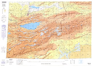
Map including Hsin-ho (Torpak Bazar) and surrounding region from the International Map of the World (AMS, 1950)[a]
Map including Xinhe (DMA, 1981)

From the Operational Navigation Chart; map including Hsin-ho (Toksu) (DMA, 1985)[b]


Notes[]
References[]
- ^ Jump up to: a b c 3-7 各地、州、市、县(市)分民族人口数 (in Chinese). شىنجاڭ ئۇيغۇر ئاپتونوم رايونى 新疆维吾尔自治区统计局 Statistic Bureau of Xinjiang Uygur Autonomous Region. Archived from the original on 2017-10-11. Retrieved 2017-09-03.
- ^ 1997年新和县行政区划. XZQH.org. 10 November 2010. Retrieved 8 June 2020.
阿克苏地区辖县。位于天山南麓,塔里木盆地北缘。为古丝绸之路的必经之地。面积8223平方千米,人口12.5万,其中维吾尔族占95.5%,
- ^ 新和县县情简介. 阿克苏政府网 (in Chinese). 26 April 2020. Retrieved 8 June 2020.
- ^ Jump up to: a b c 新和县历史沿革 [Toksu County Historical Development] (in Chinese). XZQH.org. 30 January 2015. Retrieved 31 May 2019.
2003年,新和县总面积5830.99平方千米,
- ^ Jump up to: a b c d e 夏征农; 陈至立, eds. (September 2009). 辞海:第六版彩图本 [Cihai (Sixth Edition in Color)] (in Chinese). 上海. Shanghai: 上海辞书出版社. Shanghai Lexicographical Publishing House. p. 2542. ISBN 9787532628599.
1944年改新和县{...}5831平方千米
- ^ Shohret Hoshur, Joshua Lipes (23 August 2010). "More Arrests in Aksu Blast". Radio Free Asia. Translated by Shohret Tursun, Luisetta Mudie. Retrieved 8 June 2020.
An official who answered the phone at the Toksu county government office, east of Aksu, denied the bombing existed.
CS1 maint: uses authors parameter (link) - ^ توقسۇ (Variant Non-Roman Script - VS) at GEOnet Names Server, United States National Geospatial-Intelligence Agency
- ^ Jump up to: a b c 历史沿革. 新和县人民政府 (in Chinese). 29 April 2014. Archived from the original on 11 May 2015 – via Internet Archive.
- ^ 行政区划. توقسۇ 新和县人民政府 (in Chinese). Archived from the original on 31 May 2020. Retrieved 31 May 2020.
- ^ 2019年统计用区划代码和城乡划分代码:新和县 [2019 Statistical Area Numbers and Rural-Urban Area Numbers: Toksu City] (in Chinese). National Bureau of Statistics of the People's Republic of China. 2019. Retrieved 31 May 2019.
统计用区划代码 名称 652925100000 新和镇 652925101000 尤鲁都斯巴格镇 652925102000 依其艾日克镇 652925103000 塔什艾日克镇 652925201000 排先拜巴扎乡 652925203000 渭干乡 652925204000 玉奇喀特乡 652925205000 塔木托格拉克乡 652925300000 央塔库都片区管委会乡 652925500000 新和县轻工业园区生活区 652925502000 新和县物流园区生活区 652925503000 新和县新材料园区生活区
- ^ Zhong Xingqi 钟兴麒, ed. (July 2008). 西域地名考录 (in Chinese). Beijing: 国家图书馆出版社. p. 1125. ISBN 978-7-5013-3628-9.
尤鲁都斯 yóu lǔ dū sī Yultuzbaġ 乡名。新疆新和县尤鲁都斯巴格乡,乡政府驻地在县城西南17公里。1990年叶先巴扎乡为尤鲁都斯巴格乡。
- ^ Payxambabazar (Approved - N) at GEOnet Names Server, United States National Geospatial-Intelligence Agency
- ^ Morris Rossabi, ed. (2004). Governing China's Multiethnic Frontiers (PDF). University of Washington Press. p. 179. ISBN 0-295-98390-6.
| show Authority control |
|---|
Coordinates: 41°33′01″N 82°37′00″E / 41.55028°N 82.61667°E

This Xinjiang location article is a stub. You can help Wikipedia by . |
- County-level divisions of Xinjiang
- Aksu Prefecture
- Xinjiang geography stubs