Yongchuan District
Yongchuan
永川区 | |
|---|---|
 Skyline of Yongchuan | |
 | |
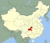
 Yongchuan District in Chongqing | |
| Country | People's Republic of China |
| Municipality | Chongqing |
| Time zone | UTC+8 (China Standard) |
| Website | http://yc.cq.gov.cn/ |
Yongchuan (Chinese: 永川; pinyin: Yǒngchuān Qū) is a district of Chongqing, China, located by the north side of upper reach of Yangtze River, with a history of 1200 years. Yongchuan borders Sichuan province to the southwest and is 63 km (39 mi) away from Yuzhong District of central Chongqing and 276 km (171 mi) from Chengdu.
Administration[]
Yongchuan District administers 19 townships and 3 subdistricts.
| Name | Chinese (S) | Hanyu Pinyin | Population (2010)[1] | Area (km2) |
|---|---|---|---|---|
| 中山路街道 | Zhōngshānlù Jiēdào | 192,954 | 61.57 | |
| 胜利路街道 | Shènglìlù Jiēdào | 134,218 | 61.76 | |
| 南大街街道 | Nándàjiē Jiēdào | 88,948 | 78.3 | |
| 茶山竹海街道 | Cháshānzhúhǎi Jiēdào | 42,383 | 96.6 | |
| 大安街道 | Dà'ān Jiēdào | 48,371 | 92.46 | |
| 陈食街道 | Chénshí Jiēdào | 39,863 | 84 | |
| 卫星湖街道 | Wèixīnghú Jiēdào | 38,112 | 67.83 | |
| town | 青峰镇 | Qīngfēng Zhèn | 19,627 | 49 |
| town | 金龙镇 | Jīnlóng Zhèn | 21,665 | 91.56 |
| town | 临江镇 | Línjiāng Zhèn | 25,740 | 77.1 |
| town | 何埂镇 | Hégěng Zhèn | 38,106 | 81 |
| town | 松溉镇 | Sōnggài Zhèn | 14,270 | 34 |
| town | 仙龙镇 | Xiānlóng Zhèn | 36,561 | 83.2 |
| town | 吉安镇 | Jí'ān Zhèn | 20,978 | 60.01 |
| town | 五间镇 | Wǔjiān Zhèn | 19,861 | 35.5 |
| town | 来苏镇 | Láisū Zhèn | 41,361 | 95.6 |
| town | 宝峰镇 | Bǎofēng Zhèn | 14,007 | 39 |
| town | 双石镇 | Shuāngshí Zhèn | 24,315 | 66 |
| town | 红炉镇 | Hónglú Zhèn | 21,618 | 64 |
| town | 永荣镇 | Yǒngróng Zhèn | 14,305 | 43 |
| Sanjiao town | 三教镇 | Sānjiào Zhèn | 46,458 | 108 |
| town | 板桥镇 | Bǎnqiáo Zhèn | 22,725 | 70.77 |
| town | 朱沱镇 | Zhūtuó Zhèn | 58,262 | 128 |
History[]
Yongchuan enjoys a history of 1200 years.
- In 776, Yongchuan county was established.
- In 1983, Yongchuan county was put under the administration of Chongqing city.
- In 1992, Yongchuan county was promoted to a city level, called Yongchuan city.
- In 2006, Yongchuan city was changed into Yongchuan district, a county-level division of Chongqing.
Geographic condition[]
Yongchuan is in west Chongqing, in border with Bishan and Jiangjin in east, with Dazu and Rongchang in west, with Tongliang in north, and with and Hejiang. Yongchuan is located in 05°37′31″-106°5′7″ of longitude and 28°56′16″-29°34′30″ of north latitude. It is 70.65 km (43.90 mi) long from south end to north end and 44.85 km (27.87 mi) wide from east end to north end, total area is 1,572.66 km2 (607.21 sq mi).
Weather condition[]
The climate of Yongchuan belongs to subtropic monsoon weather style, with an annual average temperature of 18.6℃, monthly average temperature of 7.1℃ in January, 28℃ in July, total annual radiation of 1273.6 hrs, total annual rainfall of 1034 mm, frost-free period of 317 days .
Transportation[]
The Yangtze river passes through Jiangjin, making up a 17.6 [km] long waterway. Both the Chengdu-Chongqing freeway and Chengdu-Chongqing railway have their ways across Yongchuan, which make up a very convenient traffic condition.
Economy[]
- Yongchuan is one of important agricultural production areas in China, with a products include of rice, wheat, sweet potato, tea, vegetables, fruits, silk and bamboo. Its animal husbandry include pig raising etc.
- In 2006, its total annual GDP was CNY12.194 billion.
Tourism[]
The famous tourism place in Yongchuan is the Tea Mountain and Bamboo Sea.
References[]
- ^ shi, Guo wu yuan ren kou pu cha ban gong; council, Guo jia tong ji ju ren kou he jiu ye tong ji si bian = Tabulation on the 2010 population census of the people's republic of China by township / compiled by Population census office under the state; population, Department of; statistics, employment statistics national bureau of (2012). Zhongguo 2010 nian ren kou pu cha fen xiang, zhen, jie dao zi liao (Di 1 ban. ed.). Beijing Shi: Zhongguo tong ji chu ban she. ISBN 978-7-5037-6660-2.
External links[]

Coordinates: 29°22′N 105°54′E / 29.367°N 105.900°E

| Authority control |
|
|---|
- Districts of Chongqing