Pengshui Miao and Tujia Autonomous County
Pengshui
彭水县 | |
|---|---|
彭水苗族土家族自治县 Pengshui Miao and Tujia Autonomous County | |
 | |
 | |
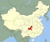
 Location of Pengshui County in Chongqing | |
| Country | People's Republic of China |
| Municipality | Chongqing |
| Area | |
| • Total | 3,903 km2 (1,507 sq mi) |
| Population (2010) | |
| • Total | 545,094 |
| • Density | 140/km2 (360/sq mi) |
| Time zone | UTC+8 (China Standard) |
| Website | www |
Pengshui Miao and Tujia Autonomous County (simplified Chinese: 彭水苗族土家族自治县; traditional Chinese: 彭水苗族土家族自治縣; pinyin: Péngshuǐ Miáozú Tǔjiāzúzìzhìxiàn) is an autonomous county for the Miao and Tujia people located in southeastern Chongqing, China, bordering Guizhou province to the south and southwest and Hubei province to the northeast.[1] It is 270 kilometres (170 mi) away from downtown Chongqing.[citation needed]
The county spans an area of 3,903 square kilometres (1,507 sq mi),[2] and has a population of 545,094 as of 2010.[3] The county's government is located in .[1]
History[]
During the Shang dynasty and the Zhou dynasty, the region of contemporary Pengshui belonged to the State of Ba.[3] During the Warring States period, the area belonged to the Qianzhong Commandery, which would later be incorporated into the Qin dynasty.[3]
During the Han dynasty, the area would be reorganized as Fuling County (Chinese: 涪陵縣).[3]
Under the Sui dynasty,[3] in 593 CE,[citation needed] the area was organized as Pengshui County (Chinese: 彭水縣).[3] "Pengshui" means "Peng River",[3] which was the old name for the Yu River.[citation needed] During the Tang dynasty, Pengshui County was put under the administration of and .[3] Under the Song dynasty, Pengshui was administered by .[3] Under the Yuan dynasty, it was administered by .[3] By 1645 during the Qing Dynasty, it was part of Chongqing Prefecture (Chinese: 重慶府).[citation needed] In 1913 (Republic of China), it was part of Dongchuan Circuit (Chinese: 東川道).[citation needed] In 1927, it was reassigned to Changgong Bureau (Chinese: 長公署) of Sichuan Province.[citation needed] And in 1935, of the Eighth Administrative Inspection Area (Chinese: 第八行政督察區) of Sichuan.[citation needed]
People's Republic of China[]
On November 16, 1949, Pengshui was captured by the communists. In January[citation needed] 1950, it was put under the jurisdiction of ,[3] under Chuandong administrative territory (Chinese: 川東行署涪陵專區).[citation needed] In September 1952, Fuling Special District was transferred to Sichuan, and was changed to a prefecture in June 1968.[citation needed]
On November 14,[citation needed] 1983 Pengshui was approved as an autonomous county.[3] The official status began November 10 of the following year.[citation needed] In 1987, it was assigned to .[3] In June[citation needed] 1997, it fell under the administration of Chongqing, which it remains today.[3]
Geography[]

Pengshui Miao and Tujia Autonomous County is located in the Sichuan Basin along the Wu River,[1] in the mountainous region of Wuling.[citation needed] 54.2% of Pengshui is covered by forest.[2] Geographic coordinates: 28°57′ – 29° 51′ North, 107°48′ – 108°36′ East.[citation needed] Altitude of the seat: 245 m (804 ft).[citation needed]
The county is home to three peaks over 1,000 metres (3,300 ft) above sea level: Qiliangzi (Chinese: 七梁子) at 1,434 metres (4,705 ft), Baila Mountain (Chinese: 白蜡山) at 1,393 metres (4,570 ft), and Fenghuang Mountain (Chinese: 凤凰山) at 1,048 metres (3,438 ft).[1]
Neighbours:[citation needed]
- North: Shizhu Tujia Autonomous County
- Northeast: Lichuan City, Enshi Tujia and Miao Autonomous Prefecture, Hubei
- East: Qianjiang District
- Southeast: Youyang Tujia and Miao Autonomous County
- South: Yanhe Tujia Autonomous County, Guizhou; Wuchuan Gelao and Miao Autonomous County
- Southwest: Daozhen Gelao and Miao Autonomous County, Guizhou
- West: Wulong County
- Northwest: Fengdu County
Climate[]
The county's average annual temperature is 17.6 °C (63.7 °F), and the average annual precipitation is 1,235 millimetres (48.6 in).[1]
Demographics[]
As of the 2010 Chinese Census, the county had a population 545,094, down from the 590,228 reported in the 2000 Chinese Census.[3] In 1996, the county had an estimated population of 587,000.[3]
59.5% of Pengshui residents are members of the following 11 ethnic minorities: Miao, Tujia, Mongols, Hui, Gelao, Dong, Tibetans, Manchus, Zhuang, Yi, and Hani.[citation needed] There are 270,000 Miao and 90,000 Tujia in Pengshui.[citation needed]
Subdivisions[]
As of 2020, the county administers 3 subdistricts, 18 towns, and 18 townships.[4]
Subdistricts[]
The county administers the following 3 subdistricts:[4]
Towns[]
The county administers the following 18 towns:[4]
Townships[]
The county administers the following 18 townships:[4]
Economy[]
Mineral deposits in the county include coal, barite, marble, fluorite, and calcite.[1]
Transportation[]
The Chongqing–Huaihua railway runs through the county.[1] Major expressways which pass through the county include the G65 Baotou–Maoming Expressway and National Highway 319.[1]
References[]
- ^ Jump up to: a b c d e f g h 彭水县概况地图 [Pengshui County Overview]. xzqh.org (in Chinese). 2014-12-08. Archived from the original on 2021-03-26. Retrieved 2021-03-26.
- ^ Jump up to: a b 彭水概况 [Pengshui Overview] (in Chinese). Pengshui Miao and Tujia Autonomous County People's Government. 2019-11-11. Archived from the original on 2021-03-26. Retrieved 2021-03-26.
- ^ Jump up to: a b c d e f g h i j k l m n o p 彭水县历史沿革 [Pengshui County Organizational History]. xzqh.org (in Chinese). 2014-12-08. Archived from the original on 2021-03-26. Retrieved 2021-03-26.
- ^ Jump up to: a b c d 2020年统计用区划代码(彭水苗族土家族自治县) [2020 Statistical Division Codes (Pengshui Miao and Tujia Autonomous County)] (in Chinese). National Bureau of Statistics of China. 2020. Archived from the original on 2021-03-25. Retrieved 2021-03-25.
External links[]
- Official site (2020)
- Official site (2003)
- Sacrificed to the river god China Daily report on the flooding of Gongtan village for a nearby hydroplant

| show Authority control |
|---|
- Miao autonomous counties
- County-level divisions of Chongqing
- Tujia autonomous counties