Jiulongpo District
This article needs additional citations for verification. (September 2014) |
Jiulongpo
九龙坡区 | |
|---|---|
 | |
 | |
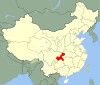
 Jiulongpo District in Chongqing | |
| Country | People's Republic of China |
| Municipality | Chongqing |
| Time zone | UTC+8 (China Standard) |
Jiulongpo (simplified Chinese: 九龙坡; traditional Chinese: 九龍坡; pinyin: Jiǔlóngpō Qū) is a district forming part of the western part of the Chongqing urban core (重庆主城区). Its total population is around 675,000, while its urban city population is nearly 650,000 (2005).[citation needed]
Location[]
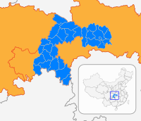
Jiulongpo is one of the main districts in Chongqing, around which are Yuzhong, Shapingba and Dadukou, while Banan and Nan'an are separated from Jiulongpo with rivers. The government of Jiulongpo is in .[citation needed]
Administrative divisions[]
| Name | Chinese (S) | Hanyu Pinyin | Population (2010)[2] | Area (km2) |
|---|---|---|---|---|
| 杨家坪街道 | Yángjiāpíng Jiēdào | 111,578 | 3.1 | |
| 黄桷坪街道 | Huángjuépíng Jiēdào | 64,112 | 4.6 | |
| 谢家湾街道 | Xièjiāwān Jiēdào | 78,227 | 3.8 | |
| 石坪桥街道 | Shípíngqiáo Jiēdào | 72,281 | 1.3 | |
| 石桥铺街道 | Shíqiáopù Jiēdào | 143,928 | 7.643 | |
| 二郎街道 | Èrláng Jiēdào | 6.5 | ||
| 中梁山街道 | Zhōngliángshān Jiēdào | 88,739 | 19.4 | |
| 渝州路街道 | Yúzhōulù Jiēdào | 90,840 | 159.812 | |
| town | 九龙镇 | Jiǔlóng Zhèn | 82,052 | 10 |
| town | 华岩镇 | Huáyán Zhèn | 46,677 | 25.5 |
| town | 含谷镇 | Hángǔ Zhèn | 37,175 | 29.5 |
| Jinfeng town | 金凤镇 | Jīnfèng Zhèn | 16,305 | 38.5 |
| town | 白市驿镇 | Báishìyì Zhèn | 74,989 | 52.3 |
| town | 走马镇 | Zǒumǎ Zhèn | 15,632 | 29.9 |
| town | 石板镇 | Shíbǎn Zhèn | 9,308 | 24.6 |
| town | 巴福镇 | Bāfú Zhèn | 14,728 | 18.15 |
| town | 陶家镇 | Táojiā Zhèn | 16,467 | 42.5 |
| town | 西彭镇 | Xīpéng Zhèn | 102,020 | 87 |
| town | 铜罐驿镇 | Tóngguànyì Zhèn | 19,361 | 23.2 |
Schools[]
The following schools are in Jiulongpo District:[citation needed]
- Chongqing Yucai Middle School
- Chongqing Qinghua Middle School
Transport[]
Metro[]
Jiulongpo is currently served by two metro lines operated by Chongqing Rail Transit:
- Line 1 - Xietaizi, Shiqiaopu
- Line 2 - Yuanjiagang, Xiejiawan, Yangjiaping, Chongqing Zoo, Dayancun, Mawangchang
See also[]
References[]
- ^ "Chongqing – Huangjueping Graffiti Street". movingcities.org. 13 February 2013. Retrieved 24 September 2014. External link in
|publisher=(help) - ^ shi, Guo wu yuan ren kou pu cha ban gong; council, Guo jia tong ji ju ren kou he jiu ye tong ji si bian = Tabulation on the 2010 population census of the people's republic of China by township / compiled by Population census office under the state; population, Department of; statistics, employment statistics national bureau of (2012). Zhongguo 2010 nian ren kou pu cha fen xiang, zhen, jie dao zi liao (Di 1 ban. ed.). Beijing Shi: Zhongguo tong ji chu ban she. ISBN 978-7-5037-6660-2.

| show Authority control |
|---|
Coordinates: 29°31′46″N 106°30′43″E / 29.5294°N 106.512°E

This Chongqing location article is a stub. You can help Wikipedia by . |
- Jiulongpo District
- Districts of Chongqing
- Southwest China geography stubs
- Chongqing stubs