Écromagny
hideThis article has multiple issues. Please help or discuss these issues on the talk page. (Learn how and when to remove these template messages)
|
Écromagny | |
|---|---|
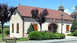 The town hall in Écromagny | |
 Coat of arms | |
show Location of Écromagny | |
 Écromagny | |
| Coordinates: 47°47′39″N 6°33′51″E / 47.7942°N 6.5642°ECoordinates: 47°47′39″N 6°33′51″E / 47.7942°N 6.5642°E | |
| Country | France |
| Region | Bourgogne-Franche-Comté |
| Department | Haute-Saône |
| Arrondissement | Lure |
| Canton | Mélisey |
| Area 1 | 6.80 km2 (2.63 sq mi) |
| Population (Jan. 2018)[1] | 157 |
| • Density | 23/km2 (60/sq mi) |
| Time zone | UTC+01:00 (CET) |
| • Summer (DST) | UTC+02:00 (CEST) |
| INSEE/Postal code | 70210 /70270 |
| Elevation | 370–492 m (1,214–1,614 ft) |
| 1 French Land Register data, which excludes lakes, ponds, glaciers > 1 km2 (0.386 sq mi or 247 acres) and river estuaries. | |


Écromagny is a commune in the Haute-Saône department in the region of Bourgogne-Franche-Comté in eastern France.
See also[]
References[]
- ^ "Populations légales 2018". INSEE. 28 December 2020.
| Wikimedia Commons has media related to Écromagny. |
This Haute-Saône geographical article is a stub. You can help Wikipedia by . |
Categories:
- Communes of Haute-Saône
- Haute-Saône geography stubs