Chambornay-lès-Pin
From Wikipedia, the free encyclopedia
Commune in Bourgogne-Franche-Comté, France
Chambornay-lès-Pin | |
|---|---|
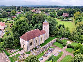 The church in Chambornay-lès-Pin | |
 Chambornay-lès-Pin  Chambornay-lès-Pin | |
Coordinates:  47°20′18″N 5°54′28″E / 47.3383°N 5.9078°E / 47.3383; 5.9078Coordinates: 47°20′18″N 5°54′28″E / 47.3383°N 5.9078°E / 47.3383; 5.9078 47°20′18″N 5°54′28″E / 47.3383°N 5.9078°E / 47.3383; 5.9078Coordinates: 47°20′18″N 5°54′28″E / 47.3383°N 5.9078°E / 47.3383; 5.9078 | |
| Country | France |
| Region | Bourgogne-Franche-Comté |
| Department | Haute-Saône |
| Arrondissement | Vesoul |
| Canton | Marnay |
| Area 1 | 4.85 km2 (1.87 sq mi) |
| Population (Jan. 2018)[1] | 359 |
| • Density | 74/km2 (190/sq mi) |
| Time zone | UTC+01:00 (CET) |
| • Summer (DST) | UTC+02:00 (CEST) |
| INSEE/Postal code | 70119 /70150 |
| Elevation | 202–276 m (663–906 ft) |
| 1 French Land Register data, which excludes lakes, ponds, glaciers > 1 km2 (0.386 sq mi or 247 acres) and river estuaries. | |

Chambornay-lès-Pin is a commune in the Haute-Saône department in the region of Bourgogne-Franche-Comté in eastern France.
See also[]
References[]
- ^ "Populations légales 2018". INSEE. 28 December 2020.
| Wikimedia Commons has media related to Chambornay-lès-Pin. |
This Haute-Saône geographical article is a stub. You can help Wikipedia by . |
Retrieved from ""
Categories:
- Communes of Haute-Saône
- Haute-Saône geography stubs
Hidden categories:
- Articles with short description
- Short description is different from Wikidata
- Infobox mapframe without OSM relation ID on Wikidata
- Coordinates on Wikidata
- Pages using infobox settlement with image map1 but not image map
- Commons category link from Wikidata
- Articles with BNF identifiers
- All stub articles
- Pages using the Kartographer extension