Cerre-lès-Noroy
Cerre-lès-Noroy | |
|---|---|
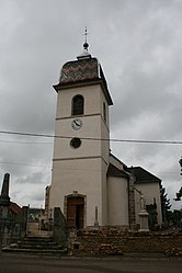 The church in Cerre-lès-Noroy | |
Location of Cerre-lès-Noroy  | |
 Cerre-lès-Noroy | |
| Coordinates: 47°36′05″N 6°19′01″E / 47.6014°N 6.3169°ECoordinates: 47°36′05″N 6°19′01″E / 47.6014°N 6.3169°E | |
| Country | France |
| Region | Bourgogne-Franche-Comté |
| Department | Haute-Saône |
| Arrondissement | Vesoul |
| Canton | Villersexel |
| Government | |
| • Mayor (2020–2026) | Gilbert Henry |
| Area 1 | 9.96 km2 (3.85 sq mi) |
| Population (Jan. 2018)[1] | 232 |
| • Density | 23/km2 (60/sq mi) |
| Time zone | UTC+01:00 (CET) |
| • Summer (DST) | UTC+02:00 (CEST) |
| INSEE/Postal code | 70115 /70000 |
| Elevation | 285–438 m (935–1,437 ft) |
| 1 French Land Register data, which excludes lakes, ponds, glaciers > 1 km2 (0.386 sq mi or 247 acres) and river estuaries. | |


Cerre-lès-Noroy (French pronunciation: [sɛʁ lɛ nɔʁwa], literally Cerre near Noroy) is a commune in the Haute-Saône department in the region of Bourgogne-Franche-Comté in eastern France.
See also[]
References[]
- ^ "Populations légales 2018". The National Institute of Statistics and Economic Studies. 28 December 2020.
| Wikimedia Commons has media related to Cerre-lès-Noroy. |
This Haute-Saône geographical article is a stub. You can help Wikipedia by . |
Categories:
- Communes of Haute-Saône
- Haute-Saône geography stubs