Albaret-Sainte-Marie
Albaret-Sainte-Marie | |
|---|---|
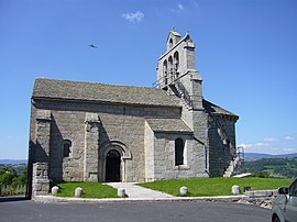 The church of Albaret | |
show Location of Albaret-Sainte-Marie | |
 Albaret-Sainte-Marie | |
| Coordinates: 44°52′59″N 3°14′53″E / 44.8831°N 3.2481°ECoordinates: 44°52′59″N 3°14′53″E / 44.8831°N 3.2481°E | |
| Country | France |
| Region | Occitanie |
| Department | Lozère |
| Arrondissement | Mende |
| Canton | Saint-Chély-d'Apcher |
| Intercommunality | |
| Government | |
| • Mayor (2020–2026) | Michel Thérond[1] |
| Area 1 | 15.98 km2 (6.17 sq mi) |
| Population (Jan. 2018)[2] | 565 |
| • Density | 35/km2 (92/sq mi) |
| Time zone | UTC+01:00 (CET) |
| • Summer (DST) | UTC+02:00 (CEST) |
| INSEE/Postal code | 48002 /48200 |
| Elevation | 767–1,139 m (2,516–3,737 ft) (avg. 970 m or 3,180 ft) |
| 1 French Land Register data, which excludes lakes, ponds, glaciers > 1 km2 (0.386 sq mi or 247 acres) and river estuaries. | |


Albaret-Sainte-Marie is a commune in the Lozère department in southern France.
Population[]
| Year | Pop. | ±% |
|---|---|---|
| 2005 | 520 | — |
| 2006 | 522 | +0.4% |
| 2007 | 537 | +2.9% |
| 2008 | 548 | +2.0% |
| 2009 | 556 | +1.5% |
| 2010 | 564 | +1.4% |
| 2011 | 567 | +0.5% |
| 2012 | 569 | +0.4% |
| 2013 | 567 | −0.4% |
| 2014 | 568 | +0.2% |
| 2015 | 568 | +0.0% |
| 2016 | 571 | +0.5% |
See also[]
References[]
- ^ "Répertoire national des élus: les maires". data.gouv.fr, Plateforme ouverte des données publiques françaises (in French). 2 December 2020. Retrieved 7 December 2020.
- ^ "Populations légales 2018". INSEE. 28 December 2020.
| Wikimedia Commons has media related to Albaret-Sainte-Marie. |
This Lozère geographical article is a stub. You can help Wikipedia by . |
Categories:
- Communes of Lozère
- Lozère geography stubs