Saint-Flour-de-Mercoire
Saint-Flour-de-Mercoire | |
|---|---|
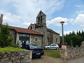 Church and Mairie | |
show Location of Saint-Flour-de-Mercoire | |
 Saint-Flour-de-Mercoire | |
| Coordinates: 44°41′47″N 3°49′34″E / 44.6964°N 3.8261°ECoordinates: 44°41′47″N 3°49′34″E / 44.6964°N 3.8261°E | |
| Country | France |
| Region | Occitanie |
| Department | Lozère |
| Arrondissement | Mende |
| Canton | Langogne |
| Intercommunality | Haut Allier |
| Government | |
| • Mayor (2020–2026) | Guy Mayrand[1] |
| Area 1 | 12.17 km2 (4.70 sq mi) |
| Population (Jan. 2018)[2] | 190 |
| • Density | 16/km2 (40/sq mi) |
| Time zone | UTC+01:00 (CET) |
| • Summer (DST) | UTC+02:00 (CEST) |
| INSEE/Postal code | 48150 /48300 |
| Elevation | 954–1,229 m (3,130–4,032 ft) (avg. 1,000 m or 3,300 ft) |
| 1 French Land Register data, which excludes lakes, ponds, glaciers > 1 km2 (0.386 sq mi or 247 acres) and river estuaries. | |


Saint-Flour-de-Mercoire (Occitan: Sant Flor de Mercoira) is a commune in the Lozère department in southern France. The Robert Louis Stevenson Trail (GR 70), a popular long-distance path, runs through the village.[3]
See also[]
References[]
- Notes
- ^ "Répertoire national des élus: les maires". data.gouv.fr, Plateforme ouverte des données publiques françaises (in French). 2 December 2020. Retrieved 7 December 2020.
- ^ "Populations légales 2018". INSEE. 28 December 2020.
- ^ Castle, Alan (2007). The Robert Louis Stevenson Trail (2nd ed.). Cicerone. pp. 99–103. ISBN 978-1-85284-511-7.
- Sources
| Wikimedia Commons has media related to Saint-Flour-de-Mercoire. |
This Lozère geographical article is a stub. You can help Wikipedia by . |
Categories:
- Communes of Lozère
- Lozère geography stubs