Angevillers
Angevillers | |
|---|---|
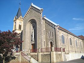 The church in Angevillers | |
 Coat of arms | |
show Location of Angevillers | |
 Angevillers | |
| Coordinates: 49°23′19″N 6°02′36″E / 49.3886°N 6.0433°ECoordinates: 49°23′19″N 6°02′36″E / 49.3886°N 6.0433°E | |
| Country | France |
| Region | Grand Est |
| Department | Moselle |
| Arrondissement | Thionville |
| Canton | Algrange |
| Intercommunality | |
| Government | |
| • Mayor (2014-2020) | Marcelle Brier |
| Area 1 | 8.71 km2 (3.36 sq mi) |
| Population (Jan. 2018)[1] | 1,252 |
| • Density | 140/km2 (370/sq mi) |
| Time zone | UTC+01:00 (CET) |
| • Summer (DST) | UTC+02:00 (CEST) |
| INSEE/Postal code | 57022 /57440 |
| Elevation | 315–418 m (1,033–1,371 ft) (avg. 363 m or 1,191 ft) |
| 1 French Land Register data, which excludes lakes, ponds, glaciers > 1 km2 (0.386 sq mi or 247 acres) and river estuaries. | |


Angevillers (Lorraine Franconian Aasler, German: Arsweiler) is a commune in the Moselle department in Grand Est in northeastern France.
Population[]
| Year | Pop. | ±% |
|---|---|---|
| 1962 | 1,196 | — |
| 1968 | 1,397 | +16.8% |
| 1975 | 1,441 | +3.1% |
| 1982 | 1,284 | −10.9% |
| 1990 | 1,175 | −8.5% |
| 1999 | 1,185 | +0.9% |
| 2006 | 1,262 | +6.5% |
| 2009 | 1,281 | +1.5% |

Former Hitler's HQ in the nearby forest
See also[]
- Communes of the Moselle department
- Ouvrage Rochonvillers, a Maginot Line fortification
References[]
- ^ "Populations légales 2018". INSEE. 28 December 2020.
| Wikimedia Commons has media related to Angevillers. |
| show Authority control |
|---|
Categories:
- Communes of Moselle (department)
- Thionville arrondissement geography stubs