Apataki Airport
Apataki Airport Aérodrome d'Apataki | |||||||||||
|---|---|---|---|---|---|---|---|---|---|---|---|
| Summary | |||||||||||
| Airport type | Public | ||||||||||
| Operator | DSEAC Polynésie Française | ||||||||||
| Serves | Apataki | ||||||||||
| Location | Apataki, Tuamotu, French Polynesia | ||||||||||
| Elevation AMSL | 3 m / 10 ft | ||||||||||
| Coordinates | 15°34′25″S 146°24′54″W / 15.57361°S 146.41500°WCoordinates: 15°34′25″S 146°24′54″W / 15.57361°S 146.41500°W | ||||||||||
| Map | |||||||||||
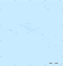 APK Location of the airport in French Polynesia | |||||||||||
| Runways | |||||||||||
| |||||||||||
Source: French AIP.[1] | |||||||||||

Apataki Airport (IATA: APK, ICAO: NTGD) is an airport on Apataki Atoll in the Tuamotu Archipelago of French Polynesia. The airport is 200 meters southwest of the village center of Niutahe, the only village of Apataki Atoll.
Airlines and destinations[]
No scheduled flights as of May 2019.[2]
See also[]
List of airports in French Polynesia
References[]
- ^ NTGD – Ahe. AIP from French Service d'information aéronautique, effective 27 January 2022.
- ^ "Download forecast schedule - Official website - Air Tahiti".
External links[]
Tuamotus Gambiers | Islands/Atolls |
| |||||
|---|---|---|---|---|---|---|---|
| Island groups | |||||||
This article about an Oceanian airport is a stub. You can help Wikipedia by . |
This French Polynesia-related geography article is a stub. You can help Wikipedia by . |
Categories:
- Airports in French Polynesia
- Atolls of the Tuamotus
- Oceanian airport stubs
- French Polynesia geography stubs