Auger-Saint-Vincent
Auger-Saint-Vincent | |
|---|---|
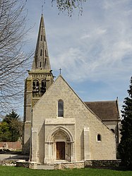 The church in Auger-Saint-Vincent | |
show Location of Auger-Saint-Vincent | |
 Auger-Saint-Vincent | |
| Coordinates: 49°13′10″N 2°48′32″E / 49.2194°N 2.8089°ECoordinates: 49°13′10″N 2°48′32″E / 49.2194°N 2.8089°E | |
| Country | France |
| Region | Hauts-de-France |
| Department | Oise |
| Arrondissement | Senlis |
| Canton | Crépy-en-Valois |
| Intercommunality | |
| Government | |
| • Mayor (2020–2026) | Fabrice Dalongeville[1] |
| Area 1 | 13.97 km2 (5.39 sq mi) |
| Population (Jan. 2018)[2] | 529 |
| • Density | 38/km2 (98/sq mi) |
| Time zone | UTC+01:00 (CET) |
| • Summer (DST) | UTC+02:00 (CEST) |
| INSEE/Postal code | 60027 /60800 |
| Elevation | 73–135 m (240–443 ft) (avg. 87 m or 285 ft) |
| 1 French Land Register data, which excludes lakes, ponds, glaciers > 1 km2 (0.386 sq mi or 247 acres) and river estuaries. | |


Auger-Saint-Vincent is a commune in the Oise department in northern France.
Population[]
|
|
See also[]
References[]
- ^ "Répertoire national des élus: les maires". data.gouv.fr, Plateforme ouverte des données publiques françaises (in French). 2 December 2020.
- ^ "Populations légales 2018". INSEE. 28 December 2020.
| Wikimedia Commons has media related to Auger-Saint-Vincent. |
| show Authority control |
|---|
This Oise geographical article is a stub. You can help Wikipedia by . |
Categories:
- Communes of Oise
- Oise geography stubs