Authezat
Authezat | |
|---|---|
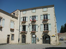 The town hall in Authezat | |
show Location of Authezat | |
 Authezat | |
| Coordinates: 45°37′56″N 3°11′07″E / 45.6322°N 3.1853°ECoordinates: 45°37′56″N 3°11′07″E / 45.6322°N 3.1853°E | |
| Country | France |
| Region | Auvergne-Rhône-Alpes |
| Department | Puy-de-Dôme |
| Arrondissement | Clermont-Ferrand |
| Canton | Les Martres-de-Veyre[1] |
| Intercommunality | |
| Government | |
| • Mayor (2020–2026) | Pierre Metzger[2] |
| Area 1 | 5.79 km2 (2.24 sq mi) |
| Population (Jan. 2018)[3] | 684 |
| • Density | 120/km2 (310/sq mi) |
| Time zone | UTC+01:00 (CET) |
| • Summer (DST) | UTC+02:00 (CEST) |
| INSEE/Postal code | 63021 /63114 |
| Elevation | 337–452 m (1,106–1,483 ft) (avg. 370 m or 1,210 ft) |
| 1 French Land Register data, which excludes lakes, ponds, glaciers > 1 km2 (0.386 sq mi or 247 acres) and river estuaries. | |


Authezat (French pronunciation: [ot(ə)za]) is a commune in the Puy-de-Dôme department in Auvergne-Rhône-Alpes in central France.
Population[]
| Year | Pop. | ±% p.a. |
|---|---|---|
| 1968 | 316 | — |
| 1975 | 320 | +0.18% |
| 1982 | 366 | +1.94% |
| 1990 | 490 | +3.71% |
| 1999 | 499 | +0.20% |
| 2007 | 628 | +2.92% |
| 2012 | 656 | +0.88% |
| 2017 | 679 | +0.69% |
| Source: INSEE[4] | ||
See also[]
References[]
- ^ "Décret 2014-210 du 21 février 2014 portant délimitation des cantons dans le département du Puy-de-Dôme" [2014-210 decree delimiting cantons of Puy-de-Dôme department]. Légifrance (in French). 21 February 2014. Retrieved 29 July 2016.
- ^ "Liste des Maires du Puy-de-Dôme" [List of Mayors of Puy-de-Dôme]. amr63.asso.fr (in French). Association of Rural Mayors of Puy-de-Dôme. Archived from the original on 24 September 2020. Retrieved 31 October 2020.
- ^ "Populations légales 2018". INSEE. 28 December 2020.
- ^ Population en historique depuis 1968, INSEE
| Wikimedia Commons has media related to Authezat. |
This Puy-de-Dôme geographical article is a stub. You can help Wikipedia by . |
Categories:
- Communes of Puy-de-Dôme
- Puy-de-Dôme geography stubs