Büllingen
Büllingen
Bullange (French) | |
|---|---|
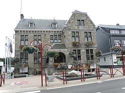 Büllingen town hall | |
 Coat of arms | |
 Büllingen Location in Belgium
show Location of Büllingen in the province of Liège | |
| Coordinates: 50°24′N 06°15′E / 50.400°N 6.250°ECoordinates: 50°24′N 06°15′E / 50.400°N 6.250°E | |
| Country | Belgium |
| Community | |
| Region | |
| Province | Liège |
| Arrondissement | Verviers |
| Government | |
| • Mayor | Friedhelm Wirtz (EG-EVG) |
| • Governing party/ies | EG-EVG |
| Area | |
| • Total | 150.49 km2 (58.10 sq mi) |
| Population (2018-01-01)[1] | |
| • Total | 5,473 |
| • Density | 36/km2 (94/sq mi) |
| Postal codes | 4760-4761 |
| Area codes | 080 |
| Website | www.buellingen.be |


Büllingen (French: Bullange) is a municipality of East Belgium, located in the Belgian province of Liège, Wallonia. On January 1, 2006, Büllingen had a total population of 5,385. The total area is 150.49 km² which gives a population density of 36 inhabitants per km².
Since 1977 Büllingen consists of 27 villages:
- Büllingen, Honsfeld, Hünningen, Mürringen
- Rocherath, Krinkelt, Wirtzfeld
- Manderfeld, Afst, Allmuthen, Andlermühle, Berterath, Buchholz, Eimerscheid, Hasenvenn, Hergersberg, , Hüllscheid, Igelmonder Hof, Igelmondermühle, Kehr, Krewinkel, Lanzerath, Losheimergraben, Medendorf, Merlscheid, Weckerath.
Geography[]
Its component village of Krewinkel includes the easternmost point in Belgium. The municipality also contains Rocherath, the highest village in Belgium, as well as the second highest point in Belgium, the Weißer Stein near Mürringen.[2]
History[]
This section needs expansion. You can help by . (June 2015) |
In the period 1815-1919 it belonged first to the Kingdom of Prussia and later to the German Empire following the unification of Germany. In 1920 it was ceded to Belgium under the terms of the Treaty of Versailles as part of the Eupen-Malmedy (East Cantons) area.
The town played a role in the Battle of the Bulge as the Germans attempted to advance through the Ardennes Forest in World War II.

Postal history[]
Büllingen post-office opened in December 1863, in the Malmedy county (Kreis) of the Aachen district (Bezirk) in the Rheinland province.[3]
Postal codes since 1969:[4] 4760 Büllingen; 4761 Rocherath. In 1969 Manderfeld 4778 (4760 in 1990).[5]
See also[]
References[]
- ^ "Wettelijke Bevolking per gemeente op 1 januari 2018". Statbel. Retrieved 9 March 2019.
- ^ "Büllingen: the record holder". Deutschsprachige Gemeinschaft Belgiens. Archived from the original on 2012-03-23. Retrieved 2011-05-07.
- ^ Nachverwendete Altdeutschland-Stempel, Spezialkatalog und Handbuch, Peter Feuser, 1983 Stuttgart.
- ^ Liste des Numéros Postaux, Administration des Postes, Bruxelles 1969.
- ^ Les numéros postaux belges en vigueur à partir du 1/10/1990, La Poste.
External links[]
 Media related to Büllingen at Wikimedia Commons
- (in German) Official website
| show Places adjacent to Büllingen |
|---|
| show Municipalities in the province of Liège, Wallonia |
|---|

| show Authority control |
|---|
- Büllingen