Geer
This article relies largely or entirely on a single source. (April 2021) |
Geer
Djer (Walloon) | |
|---|---|
 | |
 Coat of arms | |
 Geer Location in Belgium
show Location of Geer in the province of Liège | |
| Coordinates: 50°40′N 05°10′E / 50.667°N 5.167°ECoordinates: 50°40′N 05°10′E / 50.667°N 5.167°E | |
| Country | Belgium |
| Community | French Community |
| Region | |
| Province | Liège |
| Arrondissement | Waremme |
| Government | |
| • Mayor | Dominique Servais (independent) |
| • Governing party/ies | Intérêts communaux(independent) |
| Area | |
| • Total | 23.62 km2 (9.12 sq mi) |
| Population (2018-01-01)[1] | |
| • Total | 3,430 |
| • Density | 150/km2 (380/sq mi) |
| Postal codes | 4250, 4252-4254 |
| Area codes | 019 |
| Website | www.geer.be |


Geer (Walloon: Djer) is a municipality of Wallonia located in the province of Liège, Belgium.
On January 1, 2006, Geer had a total population of 2,854. The total area is 23.62 km² which gives a population density of 121 inhabitants per km². Geer lies along the upper course of the river Jeker, which is called Geer in French.
The municipality consists of the following districts: Boëlhe, Darion, Geer, Hollogne-sur-Geer, Lens-Saint-Servais, Ligney, and Omal.
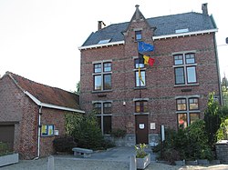
Town hall
See also[]
References[]
- ^ "Wettelijke Bevolking per gemeente op 1 januari 2018". Statbel. Retrieved 9 March 2019.
External links[]
 Media related to Geer at Wikimedia Commons
| show Places adjacent to Geer |
|---|
| show Municipalities in the province of liège, Wallonia |
|---|

This Liège Province location article is a stub. You can help Wikipedia by . |
Categories:
- Municipalities of Liège (province)
- Liège geography stubs