Stoumont
Stoumont | |
|---|---|
 | |
 Flag | |
 Stoumont Location in Belgium
show Location of Stoumont in the province of Liège | |
| Coordinates: 50°25′N 05°48′E / 50.417°N 5.800°ECoordinates: 50°25′N 05°48′E / 50.417°N 5.800°E | |
| Country | Belgium |
| Community | French Community |
| Region | |
| Province | Liège |
| Arrondissement | Verviers |
| Government | |
| • Mayor | José Dupont |
| Area | |
| • Total | 108.45 km2 (41.87 sq mi) |
| Population (2018-01-01)[1] | |
| • Total | 3,104 |
| • Density | 29/km2 (74/sq mi) |
| Postal codes | 4987 |
| Area codes | 080 |
| Website | www.stoumont.be |


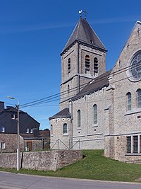
Church: l'église Saint-Hubert
Stoumont is a municipality of Wallonia located in the province of Liège, belgium.
On January 1, 2006, Stoumont had a total population of 3,006. The total area is 108.45 km2 which gives a population density of 28 inhabitants per km2.
The municipality consists of the following districts: Chevron, La Gleize, Lorcé, Rahier, and Stoumont.
See also[]
References[]
- ^ "Wettelijke Bevolking per gemeente op 1 januari 2018". Statbel. Retrieved 9 March 2019.
External links[]
 Media related to Stoumont at Wikimedia Commons
| show Places adjacent to Stoumont |
|---|
| show Municipalities in the province of liège, Wallonia |
|---|

| Authority control |
|
|---|
This Liège Province location article is a stub. You can help Wikipedia by . |
Categories:
- Municipalities of Liège (province)
- Liège geography stubs