Remicourt, Belgium
Remicourt
Remicoû (Walloon) | |
|---|---|
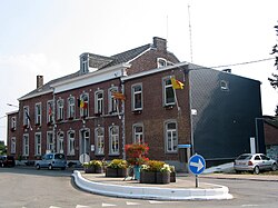 Remicourt town hall | |
 Flag | |
 Remicourt Location in Belgium
Location of Remicourt in the province of Liège  | |
| Coordinates: 50°41′N 05°20′E / 50.683°N 5.333°ECoordinates: 50°41′N 05°20′E / 50.683°N 5.333°E | |
| Country | Belgium |
| Community | French Community |
| Region | |
| Province | Liège |
| Arrondissement | Waremme |
| Government | |
| • Mayor | Jean-Marie Heyne (PS) |
| • Governing party/ies | PS |
| Area | |
| • Total | 22.58 km2 (8.72 sq mi) |
| Population (2018-01-01)[1] | |
| • Total | 5,904 |
| • Density | 260/km2 (680/sq mi) |
| Postal codes | 4350, 4351 |
| Area codes | 019 |
| Website | www.remicourt.be |

Remicourt (Walloon: Remicoû) is a municipality of Wallonia located in the province of Liège, Belgium.
On January 1, 2006, Remicourt had a total population of 5,012. The total area is 22.58 km2 which gives a population density of 222 inhabitants per km2.
The municipality consists of the following districts: , , , , and Remicourt.
See also[]
References[]
- ^ "Wettelijke Bevolking per gemeente op 1 januari 2018". Statbel. Retrieved 9 March 2019.
External links[]
 Media related to Remicourt at Wikimedia Commons
Places adjacent to Remicourt, Belgium | ||||||||||||||||
|---|---|---|---|---|---|---|---|---|---|---|---|---|---|---|---|---|
| ||||||||||||||||

This Liège Province location article is a stub. You can help Wikipedia by . |
Categories:
- Municipalities of Liège (province)
- Liège geography stubs