Waimes
Waimes
Waime (Walloon) Weismes (German) | |
|---|---|
 | |
 Flag | |
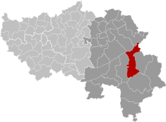
 Waimes Location in Belgium
show Location of Waimes in the province of Liège | |
| Coordinates: 50°25′N 06°07′E / 50.417°N 6.117°ECoordinates: 50°25′N 06°07′E / 50.417°N 6.117°E | |
| Country | Belgium |
| Community | French Community |
| Region | |
| Province | Liège |
| Arrondissement | Verviers |
| Government | |
| • Mayor | Daniel Stoffels |
| Area | |
| • Total | 96.93 km2 (37.42 sq mi) |
| Population (2018-01-01)[1] | |
| • Total | 7,429 |
| • Density | 77/km2 (200/sq mi) |
| Postal codes | 4950 |
| Area codes | 080 |
| Website | www.waimes.be |

Waimes (German: Weismes; Walloon: Waime) is a municipality of Wallonia located in the province of Liège, Belgium.
On January 1, 2006, Waimes had a total population of 6,728. The total area is 96.93 km2 which gives a population density of 69 inhabitants per km2.
Waimes is one of two mostly French-speaking municipalities in the East Cantons, the other being Malmedy. German as a minority language is also still widely spoken in Waimes to this day. The other surrounding municipalities in the area are part of the main German-speaking Community of Belgium.
The municipality consists of the following districts: Faymonville, Robertville, and Waimes.
See also[]
References[]
- ^ "Wettelijke Bevolking per gemeente op 1 januari 2018". Statbel. Retrieved 9 March 2019.
External links[]
 Media related to Waimes at Wikimedia Commons
- Castle Reinhardstein
| show Places adjacent to Waimes |
|---|
| show Municipalities in the province of liège, Wallonia |
|---|

| show Authority control |
|---|
Categories:
- Waimes
- Municipalities of Liège (province)