Bettange
Bettange | |
|---|---|
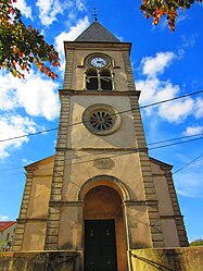 The church in Bettange | |
 Coat of arms | |
show Location of Bettange | |
 Bettange | |
| Coordinates: 49°14′14″N 6°28′57″E / 49.2372°N 6.4825°ECoordinates: 49°14′14″N 6°28′57″E / 49.2372°N 6.4825°E | |
| Country | France |
| Region | Grand Est |
| Department | Moselle |
| Arrondissement | Forbach-Boulay-Moselle |
| Canton | Boulay-Moselle |
| Government | |
| • Mayor (2020–2026) | Jean-Michel Oget[1] |
| Area 1 | 3.73 km2 (1.44 sq mi) |
| Population (Jan. 2018)[2] | 249 |
| • Density | 67/km2 (170/sq mi) |
| Time zone | UTC+01:00 (CET) |
| • Summer (DST) | UTC+02:00 (CEST) |
| INSEE/Postal code | 57070 /57220 |
| Elevation | 197–260 m (646–853 ft) (avg. 235 m or 771 ft) |
| 1 French Land Register data, which excludes lakes, ponds, glaciers > 1 km2 (0.386 sq mi or 247 acres) and river estuaries. | |


Bettange (French pronunciation: [bɛtɑ̃ʒ]; German: Bettingen) is a commune in the Moselle department in Grand Est in northeastern France.
Population[]
| Year | Pop. | ±% |
|---|---|---|
| 1962 | 145 | — |
| 1968 | 155 | +6.9% |
| 1975 | 172 | +11.0% |
| 1982 | 181 | +5.2% |
| 1990 | 185 | +2.2% |
| 1999 | 178 | −3.8% |
| 2006 | 206 | +15.7% |
| 2009 | 211 | +2.4% |
See also[]
References[]
- ^ "Répertoire national des élus: les maires". data.gouv.fr, Plateforme ouverte des données publiques françaises (in French). 2 December 2020.
- ^ "Populations légales 2018". INSEE. 28 December 2020.
| Wikimedia Commons has media related to Bettange. |
Categories:
- Communes of Moselle (department)
- Forbach-Boulay-Moselle arrondissement geography stubs