Boubiers
Boubiers | |
|---|---|
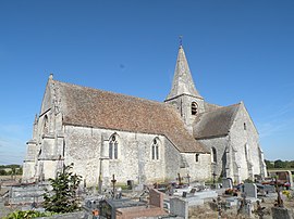 The church in Boubiers | |
show Location of Boubiers | |
 Boubiers | |
| Coordinates: 49°13′18″N 1°52′14″E / 49.2217°N 1.8706°ECoordinates: 49°13′18″N 1°52′14″E / 49.2217°N 1.8706°E | |
| Country | France |
| Region | Hauts-de-France |
| Department | Oise |
| Arrondissement | Beauvais |
| Canton | Chaumont-en-Vexin |
| Intercommunality | Vexin Thelle |
| Government | |
| • Mayor (2020–2026) | Sophie Levesque |
| Area 1 | 10.35 km2 (4.00 sq mi) |
| Population (Jan. 2018)[1] | 409 |
| • Density | 40/km2 (100/sq mi) |
| Time zone | UTC+01:00 (CET) |
| • Summer (DST) | UTC+02:00 (CEST) |
| INSEE/Postal code | 60089 /60240 |
| Elevation | 82–136 m (269–446 ft) (avg. 122 m or 400 ft) |
| 1 French Land Register data, which excludes lakes, ponds, glaciers > 1 km2 (0.386 sq mi or 247 acres) and river estuaries. | |


Boubiers (French pronunciation: [bubje]) is a commune in the Oise department in northern France.
Population[]
| Year | Pop. | ±% |
|---|---|---|
| 1793 | 305 | — |
| 1800 | 338 | +10.8% |
| 1806 | 339 | +0.3% |
| 1821 | 308 | −9.1% |
| 1831 | 347 | +12.7% |
| 1836 | 335 | −3.5% |
| 1841 | 362 | +8.1% |
| 1846 | 350 | −3.3% |
| 1851 | 354 | +1.1% |
| 1856 | 334 | −5.6% |
| 1861 | 358 | +7.2% |
| 1866 | 385 | +7.5% |
| 1872 | 343 | −10.9% |
| 1876 | 317 | −7.6% |
| 1881 | 297 | −6.3% |
| 1886 | 308 | +3.7% |
| 1891 | 292 | −5.2% |
| 1896 | 291 | −0.3% |
| 1901 | 263 | −9.6% |
| 1906 | 287 | +9.1% |
| 1911 | 296 | +3.1% |
| 1921 | 236 | −20.3% |
| 1926 | 284 | +20.3% |
| 1931 | 315 | +10.9% |
| 1936 | 315 | +0.0% |
| 1946 | 280 | −11.1% |
| 1954 | 317 | +13.2% |
| 1962 | 306 | −3.5% |
| 1968 | 291 | −4.9% |
| 1975 | 252 | −13.4% |
| 1982 | 255 | +1.2% |
| 1990 | 320 | +25.5% |
| 1999 | 370 | +15.6% |
| 2006 | 369 | −0.3% |
| 2009 | 388 | +5.1% |
| 2012 | 442 | +13.9% |
See also[]
References[]
- ^ "Populations légales 2018". INSEE. 28 December 2020.
| Wikimedia Commons has media related to Boubiers. |
This Oise geographical article is a stub. You can help Wikipedia by . |
Categories:
- Communes of Oise
- Oise geography stubs