Bouleurs
Bouleurs | |
|---|---|
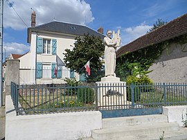 The town hall and war memorial in Bouleurs | |
show Location of Bouleurs | |
 Bouleurs | |
| Coordinates: 48°52′58″N 2°54′28″E / 48.8828°N 2.9078°ECoordinates: 48°52′58″N 2°54′28″E / 48.8828°N 2.9078°E | |
| Country | France |
| Region | Île-de-France |
| Department | Seine-et-Marne |
| Arrondissement | Meaux |
| Canton | Serris |
| Intercommunality | CA Coulommiers Pays de Brie |
| Government | |
| • Mayor (2020–2026) | Monique Bourdier[1] |
| Area 1 | 8.25 km2 (3.19 sq mi) |
| Population (Jan. 2018)[2] | 1,663 |
| • Density | 200/km2 (520/sq mi) |
| Time zone | UTC+01:00 (CET) |
| • Summer (DST) | UTC+02:00 (CEST) |
| INSEE/Postal code | 77047 /77580 |
| Elevation | 65–156 m (213–512 ft) |
| 1 French Land Register data, which excludes lakes, ponds, glaciers > 1 km2 (0.386 sq mi or 247 acres) and river estuaries. | |


Bouleurs is a commune in the Seine-et-Marne department in the Île-de-France region in north-central France.
Demographics[]
The inhabitants are called Bouleurois.
See also[]
- Communes of the Seine-et-Marne department
References[]
- ^ "Répertoire national des élus: les maires". data.gouv.fr, Plateforme ouverte des données publiques françaises (in French). 2 December 2020.
- ^ "Populations légales 2018". INSEE. 28 December 2020.
External links[]
| Wikimedia Commons has media related to Bouleurs. |
- 1999 Land Use, from IAURIF (Institute for Urban Planning and Development of the Paris-Île-de-France région) (in English)
| show Communes of the Seine-et-Marne department |
|---|
This article related to a Seine-et-Marne location is a stub. You can help Wikipedia by . |
Categories:
- Communes of Seine-et-Marne
- Seine-et-Marne geography stubs