Ury, Seine-et-Marne
Ury | |
|---|---|
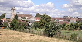 The village of Ury | |
show Location of Ury | |
 Ury | |
| Coordinates: 48°20′39″N 2°36′16″E / 48.3442°N 2.6044°ECoordinates: 48°20′39″N 2°36′16″E / 48.3442°N 2.6044°E | |
| Country | France |
| Region | Île-de-France |
| Department | Seine-et-Marne |
| Arrondissement | Fontainebleau |
| Canton | Fontainebleau |
| Intercommunality | CA Pays de Fontainebleau |
| Government | |
| • Mayor (2020–2026) | Jean-Philippe Pommeret[1] |
| Area 1 | 8.21 km2 (3.17 sq mi) |
| Population (Jan. 2018)[2] | 848 |
| • Density | 100/km2 (270/sq mi) |
| Time zone | UTC+01:00 (CET) |
| • Summer (DST) | UTC+02:00 (CEST) |
| INSEE/Postal code | 77477 /77760 |
| Elevation | 108–130 m (354–427 ft) |
| 1 French Land Register data, which excludes lakes, ponds, glaciers > 1 km2 (0.386 sq mi or 247 acres) and river estuaries. | |


Ury is a commune in the Seine-et-Marne department in the Île-de-France region in north-central France.
Demographics[]
Inhabitants of Ury are called Uriquois.
See also[]
- Communes of the Seine-et-Marne department
References[]
- ^ "Répertoire national des élus: les maires". data.gouv.fr, Plateforme ouverte des données publiques françaises (in French). 2 December 2020.
- ^ "Populations légales 2018". INSEE. 28 December 2020.
External links[]
| Wikimedia Commons has media related to Ury, Seine-et-Marne. |
- Base Mérimée: Search for heritage in the commune, Ministère français de la Culture. (in French)
| show Communes of the Seine-et-Marne department |
|---|
This article related to a Seine-et-Marne location is a stub. You can help Wikipedia by . |
Categories:
- Communes of Seine-et-Marne
- Seine-et-Marne geography stubs