Vincy-Manœuvre
Vincy-Manœuvre | |
|---|---|
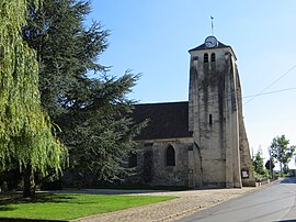 The church in Vincy-Manœuvre | |
Location of Vincy-Manœuvre  | |
 Vincy-Manœuvre | |
| Coordinates: 49°04′42″N 2°57′51″E / 49.0783°N 2.9642°ECoordinates: 49°04′42″N 2°57′51″E / 49.0783°N 2.9642°E | |
| Country | France |
| Region | Île-de-France |
| Department | Seine-et-Marne |
| Arrondissement | Meaux |
| Canton | La Ferté-sous-Jouarre |
| Intercommunality | Pays de l'Ourcq |
| Government | |
| • Mayor (2020–2026) | Gilles Durouchoux |
| Area 1 | 4.96 km2 (1.92 sq mi) |
| Population (Jan. 2018)[1] | 283 |
| • Density | 57/km2 (150/sq mi) |
| Time zone | UTC+01:00 (CET) |
| • Summer (DST) | UTC+02:00 (CEST) |
| INSEE/Postal code | 77526 /77139 |
| Elevation | 82–146 m (269–479 ft) |
| 1 French Land Register data, which excludes lakes, ponds, glaciers > 1 km2 (0.386 sq mi or 247 acres) and river estuaries. | |


Vincy-Manœuvre (French pronunciation: [vɛ̃si manœvʁ]) is a commune in the Seine-et-Marne department in the Île-de-France region in north-central France.
Demographics[]
Inhabitants of Vincy-Manœuvre are called Viniciens.
See also[]
- Communes of the Seine-et-Marne department
References[]
- ^ "Populations légales 2018". The National Institute of Statistics and Economic Studies. 28 December 2020.
| Wikimedia Commons has media related to Vincy-Manœuvre. |
Communes of the Seine-et-Marne department | |
|---|---|
|
This article related to a Seine-et-Marne location is a stub. You can help Wikipedia by . |
Categories:
- Communes of Seine-et-Marne
- Seine-et-Marne geography stubs