Germigny-l'Évêque
Germigny-l'Évêque | |
|---|---|
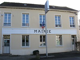 Town hall of Germigny-l'Évêque | |
show Location of Germigny-l'Évêque | |
 Germigny-l'Évêque | |
| Coordinates: 48°59′39″N 2°56′37″E / 48.9943°N 2.9435°ECoordinates: 48°59′39″N 2°56′37″E / 48.9943°N 2.9435°E | |
| Country | France |
| Region | Île-de-France |
| Department | Seine-et-Marne |
| Arrondissement | Meaux |
| Canton | La Ferté-sous-Jouarre |
| Intercommunality | Pays de Meaux |
| Government | |
| • Mayor (2020–2026) | Aline Marie-Mellare[1] |
| Area 1 | 11.76 km2 (4.54 sq mi) |
| Population (Jan. 2018)[2] | 1,316 |
| • Density | 110/km2 (290/sq mi) |
| Time zone | UTC+01:00 (CET) |
| • Summer (DST) | UTC+02:00 (CEST) |
| INSEE/Postal code | 77203 /77910 |
| Elevation | 42–104 m (138–341 ft) |
| 1 French Land Register data, which excludes lakes, ponds, glaciers > 1 km2 (0.386 sq mi or 247 acres) and river estuaries. | |


Germigny-l'Évêque (French: [ʒɛʁmini.levɛk] (![]() listen)) is a commune in the Seine-et-Marne department in the Île-de-France region in north-central France.
listen)) is a commune in the Seine-et-Marne department in the Île-de-France region in north-central France.
Demographics[]
Inhabitants are called Germinois.
Geography[]
Germigny-l'Évêque is located 9.5 km Northeast of Meaux on the left bank of the river Marne.
See also[]
- Communes of the Seine-et-Marne department
References[]
- ^ "Répertoire national des élus: les maires". data.gouv.fr, Plateforme ouverte des données publiques françaises (in French). 2 December 2020.
- ^ "Populations légales 2018". INSEE. 28 December 2020.
External links[]
| Wikimedia Commons has media related to Germigny-l'Évêque. |
- 1999 Land Use, from IAURIF (Institute for Urban Planning and Development of the Paris-Île-de-France région) (in English)
- Base Mérimée: Search for heritage in the commune, Ministère français de la Culture. (in French)
| show Communes of the Seine-et-Marne department |
|---|
This article related to a Seine-et-Marne location is a stub. You can help Wikipedia by . |
Categories:
- Communes of Seine-et-Marne
- Seine-et-Marne geography stubs