Saint-Siméon, Seine-et-Marne
Saint-Siméon | |
|---|---|
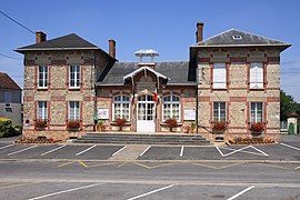 The town hall in Saint-Siméon | |
show Location of Saint-Siméon | |
 Saint-Siméon | |
| Coordinates: 48°47′54″N 3°12′12″E / 48.7983°N 3.2033°ECoordinates: 48°47′54″N 3°12′12″E / 48.7983°N 3.2033°E | |
| Country | France |
| Region | Île-de-France |
| Department | Seine-et-Marne |
| Arrondissement | Provins |
| Canton | Coulommiers |
| Government | |
| • Mayor (2020–2026) | Renée Chabrillanges |
| Area 1 | 12.3 km2 (4.7 sq mi) |
| Population (Jan. 2018)[1] | 894 |
| • Density | 73/km2 (190/sq mi) |
| Time zone | UTC+01:00 (CET) |
| • Summer (DST) | UTC+02:00 (CEST) |
| INSEE/Postal code | 77436 /77169 |
| Elevation | 80–150 m (260–490 ft) |
| 1 French Land Register data, which excludes lakes, ponds, glaciers > 1 km2 (0.386 sq mi or 247 acres) and river estuaries. | |


Saint-Siméon (French: [sɛ̃.simeɔ̃] (![]() listen)) is a commune in the Seine-et-Marne department in the Île-de-France region in north-central France.
listen)) is a commune in the Seine-et-Marne department in the Île-de-France region in north-central France.
Demographics[]
Inhabitants of Saint-Siméon are called Saint-Siméonais.
See also[]
- Communes of the Seine-et-Marne department
References[]
- ^ "Populations légales 2018". INSEE. 28 December 2020.
External links[]
| Wikimedia Commons has media related to Saint-Siméon (Seine-et-Marne). |
- 1999 Land Use, from IAURIF (Institute for Urban Planning and Development of the Paris-Île-de-France région) (in English)
- Base Mérimée: Search for heritage in the commune, Ministère français de la Culture. (in French)
| show Communes of the Seine-et-Marne department |
|---|
| show Authority control |
|---|
This article related to a Seine-et-Marne location is a stub. You can help Wikipedia by . |
Categories:
- Communes of Seine-et-Marne
- Seine-et-Marne geography stubs