Thoury-Férottes
Thoury-Férottes | |
|---|---|
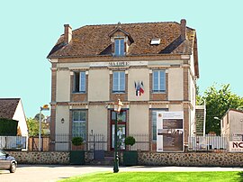 The town hall in Thoury-Férottes | |
show Location of Thoury-Férottes | |
 Thoury-Férottes | |
| Coordinates: 48°17′31″N 2°56′38″E / 48.2919°N 2.9439°ECoordinates: 48°17′31″N 2°56′38″E / 48.2919°N 2.9439°E | |
| Country | France |
| Region | Île-de-France |
| Department | Seine-et-Marne |
| Arrondissement | Provins |
| Canton | Nemours |
| Intercommunality | CC Pays de Montereau |
| Government | |
| • Mayor (2020–2026) | Yves Roy[1] |
| Area 1 | 16.47 km2 (6.36 sq mi) |
| Population (Jan. 2018)[2] | 664 |
| • Density | 40/km2 (100/sq mi) |
| Time zone | UTC+01:00 (CET) |
| • Summer (DST) | UTC+02:00 (CEST) |
| INSEE/Postal code | 77465 /77940 |
| Elevation | 72–152 m (236–499 ft) |
| 1 French Land Register data, which excludes lakes, ponds, glaciers > 1 km2 (0.386 sq mi or 247 acres) and river estuaries. | |


Thoury-Férottes is a commune in the Seine-et-Marne department in the Île-de-France region in north-central France.
Demographics[]
Inhabitants of Thoury-Férottes are called Férottois.
See also[]
- Communes of the Seine-et-Marne department
References[]
- ^ "Répertoire national des élus: les maires". data.gouv.fr, Plateforme ouverte des données publiques françaises (in French). 2 December 2020.
- ^ "Populations légales 2018". INSEE. 28 December 2020.
External links[]
| Wikimedia Commons has media related to Thoury-Férottes. |
- 1999 Land Use, from IAURIF (Institute for Urban Planning and Development of the Paris-Île-de-France région) (in English)
- Base Mérimée: Search for heritage in the commune, Ministère français de la Culture. (in French)
| show Communes of the Seine-et-Marne department |
|---|
This article related to a Seine-et-Marne location is a stub. You can help Wikipedia by . |
Categories:
- Communes of Seine-et-Marne
- Seine-et-Marne geography stubs