Broyes, Oise
Broyes | |
|---|---|
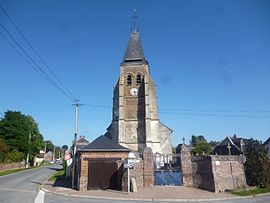 The church in Broyes | |
show Location of Broyes | |
 Broyes | |
| Coordinates: 49°37′45″N 2°27′28″E / 49.6292°N 2.4578°ECoordinates: 49°37′45″N 2°27′28″E / 49.6292°N 2.4578°E | |
| Country | France |
| Region | Hauts-de-France |
| Department | Oise |
| Arrondissement | Clermont |
| Canton | Saint-Just-en-Chaussée |
| Government | |
| • Mayor (2020–2026) | Thierry Vandeputte[1] |
| Area 1 | 4.8 km2 (1.9 sq mi) |
| Population (Jan. 2018)[2] | 162 |
| • Density | 34/km2 (87/sq mi) |
| Time zone | UTC+01:00 (CET) |
| • Summer (DST) | UTC+02:00 (CEST) |
| INSEE/Postal code | 60111 /60120 |
| Elevation | 88–156 m (289–512 ft) (avg. 185 m or 607 ft) |
| 1 French Land Register data, which excludes lakes, ponds, glaciers > 1 km2 (0.386 sq mi or 247 acres) and river estuaries. | |


Broyes (French pronunciation: [bʁwa]) is a commune in the Oise department in northern France.
Population[]
|
|
See also[]
References[]
- ^ "Répertoire national des élus: les maires". data.gouv.fr, Plateforme ouverte des données publiques françaises (in French). 2 December 2020.
- ^ "Populations légales 2018". INSEE. 28 December 2020.
| Wikimedia Commons has media related to Broyes (Oise). |
This Oise geographical article is a stub. You can help Wikipedia by . |
Categories:
- Communes of Oise
- Oise geography stubs