Brunvillers-la-Motte
Brunvillers-la-Motte | |
|---|---|
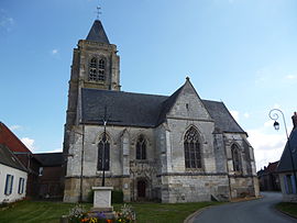 The church in Brunvillers | |
show Location of Brunvillers-la-Motte | |
 Brunvillers-la-Motte | |
| Coordinates: 49°33′00″N 2°27′05″E / 49.55°N 2.4514°ECoordinates: 49°33′00″N 2°27′05″E / 49.55°N 2.4514°E | |
| Country | France |
| Region | Hauts-de-France |
| Department | Oise |
| Arrondissement | Clermont |
| Canton | Saint-Just-en-Chaussée |
| Intercommunality | Plateau Picard |
| Government | |
| • Mayor (2008–2014) | Maurice Priem |
| Area 1 | 6.5 km2 (2.5 sq mi) |
| Population (Jan. 2018)[1] | 347 |
| • Density | 53/km2 (140/sq mi) |
| Time zone | UTC+01:00 (CET) |
| • Summer (DST) | UTC+02:00 (CEST) |
| INSEE/Postal code | 60112 /60130 |
| Elevation | 110–135 m (361–443 ft) (avg. 132 m or 433 ft) |
| 1 French Land Register data, which excludes lakes, ponds, glaciers > 1 km2 (0.386 sq mi or 247 acres) and river estuaries. | |


Brunvillers-la-Motte is a commune in the Oise department in northern France.
Population[]
| Year | Pop. | ±% |
|---|---|---|
| 1793 | 396 | — |
| 1800 | 344 | −13.1% |
| 1806 | 424 | +23.3% |
| 1821 | 351 | −17.2% |
| 1831 | 389 | +10.8% |
| 1836 | 396 | +1.8% |
| 1841 | 352 | −11.1% |
| 1846 | 359 | +2.0% |
| 1851 | 360 | +0.3% |
| 1856 | 321 | −10.8% |
| 1861 | 302 | −5.9% |
| 1866 | 332 | +9.9% |
| 1872 | 334 | +0.6% |
| 1876 | 350 | +4.8% |
| 1881 | 329 | −6.0% |
| 1886 | 337 | +2.4% |
| 1891 | 349 | +3.6% |
| 1896 | 313 | −10.3% |
| 1901 | 315 | +0.6% |
| 1906 | 316 | +0.3% |
| 1911 | 301 | −4.7% |
| 1921 | 307 | +2.0% |
| 1926 | 259 | −15.6% |
| 1931 | 252 | −2.7% |
| 1936 | 272 | +7.9% |
| 1946 | 258 | −5.1% |
| 1954 | 233 | −9.7% |
| 1962 | 224 | −3.9% |
| 1968 | 210 | −6.2% |
| 1975 | 195 | −7.1% |
| 1982 | 218 | +11.8% |
| 1990 | 353 | +61.9% |
| 1999 | 337 | −4.5% |
| 2006 | 330 | −2.1% |
| 2009 | 325 | −1.5% |
See also[]
References[]
- ^ "Populations légales 2018". INSEE. 28 December 2020.
| Wikimedia Commons has media related to Brunvillers-la-Motte. |
This Oise geographical article is a stub. You can help Wikipedia by . |
Categories:
- Communes of Oise
- Oise geography stubs