Buhl-Lorraine
Buhl-Lorraine | |
|---|---|
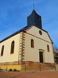 The church in Buhl-Lorraine | |
 Coat of arms | |
show Location of Buhl-Lorraine | |
 Buhl-Lorraine | |
| Coordinates: 48°43′31″N 7°05′07″E / 48.7253°N 7.0853°ECoordinates: 48°43′31″N 7°05′07″E / 48.7253°N 7.0853°E | |
| Country | France |
| Region | Grand Est |
| Department | Moselle |
| Arrondissement | Sarrebourg-Château-Salins |
| Canton | Sarrebourg |
| Government | |
| • Mayor (2020–2026) | Franck Klein[1] |
| Area 1 | 11.2 km2 (4.3 sq mi) |
| Population (Jan. 2018)[2] | 1,202 |
| • Density | 110/km2 (280/sq mi) |
| Time zone | UTC+01:00 (CET) |
| • Summer (DST) | UTC+02:00 (CEST) |
| INSEE/Postal code | 57119 /57400 |
| Elevation | 248–325 m (814–1,066 ft) |
| 1 French Land Register data, which excludes lakes, ponds, glaciers > 1 km2 (0.386 sq mi or 247 acres) and river estuaries. | |


Buhl-Lorraine (French pronunciation: [byl lɔʁɛn]; German: Bühl am Kanal) is a commune in the Moselle department in Grand Est in northeastern France.
Geography[]
The village is located in Lorraine, as its name suggests, more specifically in South Moselle.
Buhl-Lorraine is located 3 miles from Sarrebourg Height: about 260 meters.
The municipality is crossed by the Bièvre tributary of the Saar.
Population[]
| Year | Pop. | ±% |
|---|---|---|
| 2006 | 1,078 | — |
| 2009 | 1,198 | +11.1% |
See also[]
References[]
- ^ "Répertoire national des élus: les maires". data.gouv.fr, Plateforme ouverte des données publiques françaises (in French). 2 December 2020.
- ^ "Populations légales 2018". INSEE. 28 December 2020.
| Wikimedia Commons has media related to Buhl-Lorraine. |
| show Authority control |
|---|
Categories:
- Communes of Moselle (department)
- Sarrebourg-Château-Salins arrondissement geography stubs