Burlington, Colorado
Burlington, Colorado | |
|---|---|
Home rule municipality[1] | |
| City of Burlington[1] | |
 South Lincoln St. in Burlington | |
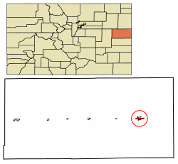 Location of the City of Burlington in Kit Carson County, Colorado. | |
 Burlington Location of the City of Burlington in the United States. | |
| Coordinates: 39°18′16″N 102°16′17″W / 39.304491°N 102.271463°WCoordinates: 39°18′16″N 102°16′17″W / 39.304491°N 102.271463°W[3] | |
| Country | |
| State | |
| County | Kit Carson County[2] |
| City | Burlington[1] |
| Government | |
| • Type | Home rule municipality[1] |
| Area | |
| • Total | 2.153 sq mi (5.575 km2) |
| • Land | 2.153 sq mi (5.575 km2) |
| • Water | 0.000 sq mi (0.000 km2) |
| Elevation | 4,170 ft (1,271 m) |
| Population | |
| • Total | 3,172 |
| • Density | 1,474/sq mi (569/km2) |
| Time zone | UTC−07:00 (MST) |
| • Summer (DST) | UTC−06:00 (MDT) |
| ZIP code | 80807 [6] |
| Area code | 719 |
| FIPS code | 08-10600 |
| GNIS feature ID | 0204822 |
| Website | www |

The City of Burlington is the home rule municipality that is the county seat and the most populous community of Kit Carson County, Colorado, United States.[8] The city population was 3,172 at the 2020 United States Census.[4]
History[]
Burlington was originally laid out one mile west of its present location in 1887 by a man named Lowell in anticipation of the arrival of the railroad. In addition to having the location wrong, Lowell also did not have title to the land. When the railroad did arrive, the Chicago, Rock Island and Pacific Railroad, it built its depot at the present site of Burlington and those who had built in Old Burlington moved their buildings to the new townsite. Trains began running in 1888. "The Settlement", about 12 miles northwest of Burlington, was settled by German immigrants from Russia, many from Hoffnungstal, South Russia, who, in addition to their homesteads, built Congregational and Lutheran churches.[9][10]
Geography[]
Burlington is located at 39°18′15″N 102°16′7″W / 39.30417°N 102.26861°W (39.304293, -102.268683)[11] on the High Plains in eastern Colorado.
At the 2020 United States Census, the city had a total area of 1,378 acres (5.575 km2), all of it land.[4]
The easternmost interchange in Colorado on Interstate 70 is located at Burlington.
Climate[]
Burlington has a typical High Plains cool semi-arid climate with hot, dry summers punctuated by occasional heavy thunderstorm rains, and cold, very dry winters. Snowfall is occasionally heavy – the 1971 to 2000 mean was 35.5 inches or 0.90 metres – but mostly the winter weather is very dry and extremely variable in temperatures. More than 33 afternoons (over a third) each winter can be expected to reach or exceed 50 °F or 10 °C, but 6.5 mornings each year will drop to or under 0 °F (−17.8 °C) and 24.6 afternoons do not top freezing.
| hideClimate data for Burlington, Colorado (1981–2010) | |||||||||||||
|---|---|---|---|---|---|---|---|---|---|---|---|---|---|
| Month | Jan | Feb | Mar | Apr | May | Jun | Jul | Aug | Sep | Oct | Nov | Dec | Year |
| Record high °F (°C) | 74 (23) |
86 (30) |
87 (31) |
92 (33) |
101 (38) |
107 (42) |
105 (41) |
103 (39) |
100 (38) |
93 (34) |
81 (27) |
76 (24) |
107 (42) |
| Mean maximum °F (°C) | 66 (19) |
66 (19) |
78 (26) |
85 (29) |
94 (34) |
99 (37) |
101 (38) |
98 (37) |
94 (34) |
87 (31) |
76 (24) |
66 (19) |
102 (39) |
| Average high °F (°C) | 43.6 (6.4) |
45.7 (7.6) |
54.7 (12.6) |
63.5 (17.5) |
74.1 (23.4) |
83.6 (28.7) |
90.3 (32.4) |
86.6 (30.3) |
79.2 (26.2) |
65.6 (18.7) |
53.5 (11.9) |
43.2 (6.2) |
65.3 (18.5) |
| Average low °F (°C) | 17.0 (−8.3) |
18.8 (−7.3) |
25.6 (−3.6) |
33.8 (1.0) |
44.3 (6.8) |
54.2 (12.3) |
60.8 (16.0) |
58.8 (14.9) |
49.3 (9.6) |
36.4 (2.4) |
25.4 (−3.7) |
16.5 (−8.6) |
36.7 (2.6) |
| Mean minimum °F (°C) | −1 (−18) |
3 (−16) |
11 (−12) |
20 (−7) |
30 (−1) |
42 (6) |
53 (12) |
51 (11) |
36 (2) |
21 (−6) |
8 (−13) |
−3 (−19) |
−7 (−22) |
| Record low °F (°C) | −12 (−24) |
−11 (−24) |
−3 (−19) |
16 (−9) |
25 (−4) |
33 (1) |
47 (8) |
45 (7) |
27 (−3) |
8 (−13) |
−3 (−19) |
−15 (−26) |
−15 (−26) |
| Average precipitation inches (mm) | 0.14 (3.6) |
0.20 (5.1) |
0.67 (17) |
1.46 (37) |
1.76 (45) |
2.29 (58) |
2.38 (60) |
2.52 (64) |
1.06 (27) |
1.50 (38) |
0.28 (7.1) |
0.24 (6.1) |
14.5 (367.9) |
| Average precipitation days (≥ 0.01 inch) | 2 | 4 | 4 | 8 | 9 | 9 | 9 | 11 | 6 | 6 | 3 | 3 | 72 |
| Source: NOAA[12] | |||||||||||||
Demographics[]
| Historical population | |||
|---|---|---|---|
| Census | Pop. | %± | |
| 1890 | 146 | — | |
| 1900 | 183 | 25.3% | |
| 1910 | 368 | 101.1% | |
| 1920 | 991 | 169.3% | |
| 1930 | 1,280 | 29.2% | |
| 1940 | 1,280 | 0.0% | |
| 1950 | 2,247 | 75.5% | |
| 1960 | 2,090 | −7.0% | |
| 1970 | 2,828 | 35.3% | |
| 1980 | 3,107 | 9.9% | |
| 1990 | 2,941 | −5.3% | |
| 2000 | 3,678 | 25.1% | |
| 2010 | 4,254 | 15.7% | |
| 2020 | 3,172 | −25.4% | |
| U.S. Decennial Census | |||
As of the census[13] of 2010, there were 4,191 people, 1,478 households, and ? families residing in the city. The population density was 1,995.7 people per square mile (776.1/km2). There were 1,478 housing units at an average density of 703.8 per square mile (273.7/km2). The racial makeup of the city was 84.3% White, 6.2% African American, 1.2% Native American, 0.5% Asian, 0.1% Pacific Islander, 8.5% from other races, and 0.90% from two or more races. Hispanic or Latino of any race were 27.5% of the population.
There were 1,287 households, out of which 32.9% had children under the age of 18 living with them, 53.0% were married couples living together, 8.6% had a female householder with no husband present, and 34.7% were non-families. 30.3% of all households were made up of individuals, and 13.9% had someone living alone who was 65 years of age or older. The average household size was 2.47 and the average family size was 3.11.
In the city, the population was spread out, with 25.2% under the age of 18, 8.6% from 18 to 24, 32.8% from 25 to 44, 19.7% from 45 to 64, and 13.7% who were 65 years of age or older. The median age was 36 years. For every 100 females, there were 121.6 males. For every 100 females age 18 and over, there were 126.2 males.
The median income for a household in the city was $33,854, and the median income for a family was $42,500. Males had a median income of $29,167 versus $19,018 for females. The per capita income for the city was $16,054. About 12.2% of families and 14.8% of the population were below the poverty line, including 20.3% of those under age 18 and 15.8% of those age 65 or over.
Government[]
Burlington is a home rule municipality.[7]
Education[]

Burlington Public Schools are part of the Burlington Public School District RE-6J. The district has one elementary school, one middle school and one high school. Burlington also has several private schools.
Burlington Elementary School, Burlington Middle School and are located in Burlington.[14]
Media[]
Print[]
Burlington has a weekly newspaper, The Burlington Record.[15] A run of 3 years, 1910–1912, of the Kit Carson County Record is archived in the Colorado Historic Newspapers Collection.[16]
Radio[]
The following radio stations are licensed to Burlington:
AM
| Frequency | Callsign[17] | Format[18] | Notes |
|---|---|---|---|
| 1140 | KNAB | Adult Standards/MOR |
FM
| Frequency | Callsign[19] | Format[18] | Notes |
|---|---|---|---|
| 88.1 | K201FK | Christian | Translator of KAWZ, Twin Falls, Idaho |
| 89.5 | K208CH | Contemporary Christian | Translator of KTLF, Colorado Springs |
| 104.1 | KNAB-FM | Country |
National Historic Landmark[]
- Kit Carson County Carousel (National Historic Landmark)
Notable people[]
Notable individuals who were born in or have lived in Burlington include:
- Mark Hillman (1967- ), Colorado state legislator[20]
- Robert P. Kerr (1892-1960), film director, actor, screenwriter[21]
- Mike Lounge (1946-2011), engineer, astronaut[22]
- Beau McCoy (1980- ), Nebraska state legislator[23]
- Susan Phillips (1949- ), Missouri state legislator[24]
See also[]
- Colorado
- Bibliography of Colorado
- Index of Colorado-related articles
- Outline of Colorado
- List of places in Colorado
- Philadelphia Toboggan Company Carousel 12
References[]
- ^ Jump up to: a b c d "Active Colorado Municipalities". State of Colorado, Colorado Department of Local Affairs, Division of Local Government. Retrieved January 25, 2021.
- ^ "Colorado Counties". State of Colorado, Colorado Department of Local Affairs, Division of Local Government. Retrieved January 25, 2021.
- ^ "2014 U.S. Gazetteer Files: Places". United States Census Bureau. July 1, 2014. Retrieved January 5, 2015.
- ^ Jump up to: a b c d "Decennial Census P.L. 94-171 Redistricting Data". United States Census Bureau, United States Department of Commerce. August 12, 2021. Retrieved September 2, 2021.
- ^ "US Board on Geographic Names". United States Geological Survey. 2007-10-25. Retrieved 2008-01-31.
- ^ "ZIP Code Lookup". United States Postal Service. Archived from the original (JavaScript/HTML) on September 3, 2007. Retrieved September 4, 2007.
- ^ Jump up to: a b "Colorado Municipal Incorporations". State of Colorado, Department of Personnel & Administration, Colorado State Archives. 2004-12-01. Retrieved 2007-09-02.
- ^ "Find a County". National Association of Counties. Archived from the original on 2011-05-31. Retrieved 2011-06-07.
- ^ "Local and Personal Happenings notice of a wedding at the Congregational church in the Settlement, page 1 Kit Carson County Record December 5, 1912
- ^ The Birth of the German Settlement in Kit Carson County, from The German Settlement of Kit Carson County, Colorado
- ^ "US Gazetteer files: 2010, 2000, and 1990". United States Census Bureau. 2011-02-12. Retrieved 2011-04-23.
- ^ "NOWData - NOAA Online Weather Data". National Oceanic and Atmospheric Administration. Retrieved May 5, 2013.
- ^ "U.S. Census website". United States Census Bureau. Retrieved 2008-01-31.
- ^ "Burlington". GreatSchools, Inc. Retrieved 2012-05-07.
- ^ "About this Newspaper: The Burlington record". Chronicling America. Library of Congress. Retrieved 2009-09-24.
- ^ Colorado Historic Newspapers Collection
- ^ "AMQ AM Radio Database Query". Federal Communications Commission. Archived from the original on 2009-08-25. Retrieved 2009-09-24.
- ^ Jump up to: a b "Station Information Profile". Arbitron. Retrieved 2009-09-24.
- ^ "FMQ FM Radio Database Query". Federal Communications Commission. Archived from the original on 2009-08-25. Retrieved 2009-09-24.
- ^ "Centennial Institute - Staff & Fellows". Colorado Christian University. Retrieved 2016-06-21.
- ^ "Robert P. Kerr". IMDb. Retrieved 2016-06-21.
- ^ "Biographical Data - John M. "Mike" Lounge". NASA. Archived from the original on 2011-04-05. Retrieved 2016-06-21.
- ^ "Beau McCoy's Biography". Vote Smart. Retrieved 2016-06-21.
- ^ "Susan Phillips' Biography". Vote Smart. Retrieved 2016-06-21.
External links[]
 Media from Wikimedia Commons
 Travel guides from Wikivoyage
| show Municipalities and communities of Kit Carson County, Colorado, United States |
|---|


| show Authority control |
|---|
- Cities in Kit Carson County, Colorado
- Cities in Colorado
- County seats in Colorado
- German-Russian culture in Colorado
- Populated places established in 1887
- 1887 establishments in Colorado