Champigny-en-Beauce
Champigny-en-Beauce | |
|---|---|
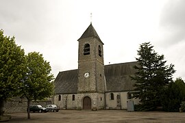 Church of Saint-Félix | |
show Location of Champigny-en-Beauce | |
 Champigny-en-Beauce | |
| Coordinates: 47°42′46″N 1°15′24″E / 47.7128°N 1.2567°ECoordinates: 47°42′46″N 1°15′24″E / 47.7128°N 1.2567°E | |
| Country | France |
| Region | Centre-Val de Loire |
| Department | Loir-et-Cher |
| Arrondissement | Blois |
| Canton | Onzain |
| Intercommunality | CA Blois Agglopolys |
| Government | |
| • Mayor (2020–2026) | Christophe Redouin |
| Area 1 | 22.31 km2 (8.61 sq mi) |
| Population (Jan. 2018)[1] | 613 |
| • Density | 27/km2 (71/sq mi) |
| Time zone | UTC+01:00 (CET) |
| • Summer (DST) | UTC+02:00 (CEST) |
| INSEE/Postal code | 41035 /41330 |
| Elevation | 92–129 m (302–423 ft) (avg. 119 m or 390 ft) |
| 1 French Land Register data, which excludes lakes, ponds, glaciers > 1 km2 (0.386 sq mi or 247 acres) and river estuaries. | |


Champigny-en-Beauce (French pronunciation: [ʃɑ̃piɲi ɑ̃ bos], literally Champigny in Beauce) is a commune in the Loir-et-Cher department in central France.
Population[]
| Year | Pop. | ±% |
|---|---|---|
| 1793 | 635 | — |
| 1806 | 619 | −2.5% |
| 1821 | 648 | +4.7% |
| 1831 | 747 | +15.3% |
| 1841 | 692 | −7.4% |
| 1851 | 709 | +2.5% |
| 1861 | 748 | +5.5% |
| 1872 | 793 | +6.0% |
| 1881 | 782 | −1.4% |
| 1891 | 771 | −1.4% |
| 1901 | 697 | −9.6% |
| 1911 | 653 | −6.3% |
| 1921 | 552 | −15.5% |
| 1931 | 603 | +9.2% |
| 1946 | 622 | +3.2% |
| 1954 | 572 | −8.0% |
| 1962 | 507 | −11.4% |
| 1968 | 462 | −8.9% |
| 1975 | 438 | −5.2% |
| 1982 | 472 | +7.8% |
| 1990 | 481 | +1.9% |
| 1999 | 553 | +15.0% |
| 2008 | 653 | +18.1% |
| 2013 | 592 | −9.3% |
See also[]
- Communes of the Loir-et-Cher department
References[]
- ^ "Populations légales 2018". INSEE. 28 December 2020.
| Wikimedia Commons has media related to Champigny-en-Beauce. |
| show Communes of the Loir-et-Cher department |
|---|
| show Authority control |
|---|
This Loir-et-Cher geographical article is a stub. You can help Wikipedia by . |
Categories:
- Communes of Loir-et-Cher
- Loir-et-Cher geography stubs