Chatignonville
Chatignonville | |
|---|---|
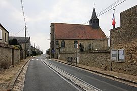 The church in Chatignonville | |
show Location of Chatignonville | |
 Chatignonville | |
| Coordinates: 48°28′09″N 1°55′51″E / 48.4692°N 1.9308°ECoordinates: 48°28′09″N 1°55′51″E / 48.4692°N 1.9308°E | |
| Country | France |
| Region | Île-de-France |
| Department | Essonne |
| Arrondissement | Étampes |
| Canton | Étampes |
| Intercommunality | CA Étampois Sud Essonne |
| Government | |
| • Mayor (2020–2026) | Christian Thierry[1] |
| Area 1 | 5.13 km2 (1.98 sq mi) |
| Population (Jan. 2018)[2] | 67 |
| • Density | 13/km2 (34/sq mi) |
| Time zone | UTC+01:00 (CET) |
| • Summer (DST) | UTC+02:00 (CEST) |
| INSEE/Postal code | 91145 /91410 |
| Elevation | 152–159 m (499–522 ft) |
| 1 French Land Register data, which excludes lakes, ponds, glaciers > 1 km2 (0.386 sq mi or 247 acres) and river estuaries. | |


Chatignonville is a commune in the Essonne department in Île-de-France in northern France.
Inhabitants of Chatignonville are known as Chatignonvillois.
References[]
- ^ "Répertoire national des élus: les maires". data.gouv.fr, Plateforme ouverte des données publiques françaises (in French). 2 December 2020.
- ^ "Populations légales 2018". INSEE. 28 December 2020.
External links[]
| Wikimedia Commons has media related to Chatignonville. |
- Mayors of Essonne Association (in French)
This Essonne geographical article is a stub. You can help Wikipedia by . |
Categories:
- Communes of Essonne
- Essonne geography stubs