Saint-Cyr-sous-Dourdan
Saint-Cyr-sous-Dourdan | |
|---|---|
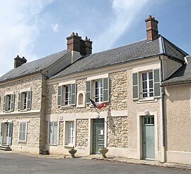 The town hall in Saint-Cyr-sous-Dourdan | |
show Location of Saint-Cyr-sous-Dourdan | |
 Saint-Cyr-sous-Dourdan | |
| Coordinates: 48°34′08″N 2°02′05″E / 48.569°N 2.0347°ECoordinates: 48°34′08″N 2°02′05″E / 48.569°N 2.0347°E | |
| Country | France |
| Region | Île-de-France |
| Department | Essonne |
| Arrondissement | Étampes |
| Canton | Dourdan |
| Government | |
| • Mayor (2020–2026) | Jean-Pierre Moulin[1] |
| Area 1 | 9.89 km2 (3.82 sq mi) |
| Population (Jan. 2018)[2] | 957 |
| • Density | 97/km2 (250/sq mi) |
| Time zone | UTC+01:00 (CET) |
| • Summer (DST) | UTC+02:00 (CEST) |
| INSEE/Postal code | 91546 /91410 |
| Elevation | 72–160 m (236–525 ft) |
| 1 French Land Register data, which excludes lakes, ponds, glaciers > 1 km2 (0.386 sq mi or 247 acres) and river estuaries. | |


Saint-Cyr-sous-Dourdan is a commune in the Essonne department in Île-de-France in northern France.
Inhabitants of Saint-Cyr-sous-Dourdan are known as Saint-Cyriens.
See also[]
References[]
- ^ "Répertoire national des élus: les maires". data.gouv.fr, Plateforme ouverte des données publiques françaises (in French). 2 December 2020.
- ^ "Populations légales 2018". INSEE. 28 December 2020.
External links[]
| Wikimedia Commons has media related to Saint-Cyr-sous-Dourdan. |
- Base Mérimée: Search for heritage in the commune, Ministère français de la Culture. (in French)
- Mayors of Essonne Association (in French)
| show Authority control |
|---|
This Essonne geographical article is a stub. You can help Wikipedia by . |
Categories:
- Communes of Essonne
- Essonne geography stubs