Mennecy
Mennecy | |
|---|---|
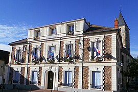 The town hall in Mennecy | |
 Coat of arms | |
show Location of Mennecy | |
 Mennecy | |
| Coordinates: 48°33′58″N 2°26′13″E / 48.5661°N 2.4369°ECoordinates: 48°33′58″N 2°26′13″E / 48.5661°N 2.4369°E | |
| Country | France |
| Region | Île-de-France |
| Department | Essonne |
| Arrondissement | Évry |
| Canton | Mennecy |
| Intercommunality | Val d'Essonne |
| Government | |
| • Mayor (2020–2026) | Jean-Philippe Dugoin-Clément |
| Area 1 | 11.09 km2 (4.28 sq mi) |
| Population (Jan. 2018)[1] | 14,679 |
| • Density | 1,300/km2 (3,400/sq mi) |
| Time zone | UTC+01:00 (CET) |
| • Summer (DST) | UTC+02:00 (CEST) |
| INSEE/Postal code | 91386 /91540 |
| Elevation | 42–97 m (138–318 ft) |
| 1 French Land Register data, which excludes lakes, ponds, glaciers > 1 km2 (0.386 sq mi or 247 acres) and river estuaries. | |


Mennecy (French pronunciation: [mɛnsi] (![]() listen)) is a commune in the Essonne department in Île-de-France in northern France.
listen)) is a commune in the Essonne department in Île-de-France in northern France.
It is 33 km south-east of Paris and crossed by the Essonne river. Inhabitants of Mennecy are known as Menneçois.
Geography[]
Mennecy is 33 kilometers south east of Paris-Notre-Dame, point zero from roads of France, 8 kilometers south of Évry, 6 kilometers south west of Corbeil-Essonnes, 11 kilometers north east of La Ferté-Alais, 14 kilometers east of Arpajon, 15 kilometers south east of Montlhéry, 19 kilometers north of Milly-la-Forêt, 22 kilometers south east of Palaiseau, 25 kilometers north east of Étampes, 31 kilometers north east of Dourdan.
Twin towns[]
Mennecy is twinned with the villages Countesthorpe in Leicestershire, United Kingdom, Occhiobello in Italy and Renningen in Baden-Württemberg, Germany.
See also[]
References[]
- ^ "Populations légales 2018". INSEE. 28 December 2020.
External links[]
| Wikimedia Commons has media related to Mennecy. |
- Official website (in French)
- Official blog (in French)
- Base Mérimée: Search for heritage in the commune, Ministère français de la Culture. (in French)
- Mayors of Essonne Association (in French)
| show Authority control |
|---|
This Essonne geographical article is a stub. You can help Wikipedia by . |
- Communes of Essonne
- Essonne geography stubs