Limours
Limours | |
|---|---|
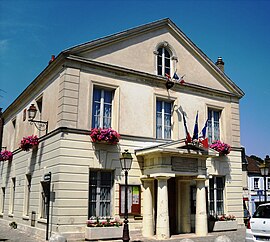 The town hall in Limours | |
 Coat of arms | |
show Location of Limours | |
 Limours | |
| Coordinates: 48°38′45″N 2°04′38″E / 48.6458°N 2.0771°ECoordinates: 48°38′45″N 2°04′38″E / 48.6458°N 2.0771°E | |
| Country | France |
| Region | Île-de-France |
| Department | Essonne |
| Arrondissement | Palaiseau |
| Canton | Dourdan |
| Intercommunality | Pays de Limours |
| Government | |
| • Mayor (2020–2026) | Jean-Raymond Hugonet (NC) |
| Area 1 | 14.25 km2 (5.50 sq mi) |
| Population (Jan. 2018)[1] | 6,558 |
| • Density | 460/km2 (1,200/sq mi) |
| Time zone | UTC+01:00 (CET) |
| • Summer (DST) | UTC+02:00 (CEST) |
| INSEE/Postal code | 91338 /91470 |
| Elevation | 100–177 m (328–581 ft) |
| 1 French Land Register data, which excludes lakes, ponds, glaciers > 1 km2 (0.386 sq mi or 247 acres) and river estuaries. | |


Limours (French pronunciation: [limuʁ] (![]() listen)) is a commune the Essonne department in Île-de-France in northern France.
listen)) is a commune the Essonne department in Île-de-France in northern France.
Inhabitants of Limours are known as Limouriens.
Geography[]
Limours is located 30 km (19 mi) from Paris.
See also[]
References[]
- ^ "Populations légales 2018". INSEE. 28 December 2020.
External links[]
 Media related to Limours at Wikimedia Commons
- Limours city council website (in French)
- Base Mérimée: Search for heritage in the commune, Ministère français de la Culture. (in French)
- Mayors of Essonne Association (in French)
| show Authority control |
|---|
This Essonne geographical article is a stub. You can help Wikipedia by . |
Categories:
- Communes of Essonne
- Essonne geography stubs