Saint-Pierre-du-Perray
Saint-Pierre-du-Perray | |
|---|---|
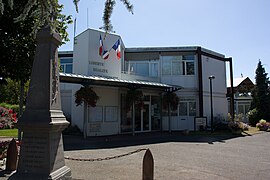 The town hall in Saint-Pierre-du-Perray | |
 Coat of arms | |
show Location of Saint-Pierre-du-Perray | |
 Saint-Pierre-du-Perray | |
| Coordinates: 48°36′44″N 2°29′43″E / 48.6123°N 2.4952°ECoordinates: 48°36′44″N 2°29′43″E / 48.6123°N 2.4952°E | |
| Country | France |
| Region | Île-de-France |
| Department | Essonne |
| Arrondissement | Évry |
| Canton | Épinay-sous-Sénart |
| Intercommunality | CA Grand Paris Sud Seine-Essonne-Sénart |
| Government | |
| • Mayor (2020–2026) | Dominique Verots |
| Area 1 | 11.59 km2 (4.47 sq mi) |
| Population (Jan. 2018)[1] | 10,930 |
| • Density | 940/km2 (2,400/sq mi) |
| Time zone | UTC+01:00 (CET) |
| • Summer (DST) | UTC+02:00 (CEST) |
| INSEE/Postal code | 91573 /91280 |
| Elevation | 32–93 m (105–305 ft) |
| 1 French Land Register data, which excludes lakes, ponds, glaciers > 1 km2 (0.386 sq mi or 247 acres) and river estuaries. | |


Saint-Pierre-du-Perray (French pronunciation: [sɛ̃ pjɛʁ dy pɛʁɛ] (![]() listen)) is a commune in the Essonne department in Île-de-France in northern France.
listen)) is a commune in the Essonne department in Île-de-France in northern France.
Inhabitants of Saint-Pierre-du-Perray are known as Saint-Perreyens.
See also[]
References[]
- ^ "Populations légales 2018". INSEE. 28 December 2020.
External links[]
| Wikimedia Commons has media related to Saint-Pierre-du-Perray. |
- Official website (in French)
- Mayors of Essonne Association (in French)
| show Authority control |
|---|
This Essonne geographical article is a stub. You can help Wikipedia by . |
Categories:
- Communes of Essonne
- Sénart
- Essonne geography stubs