Mespuits
Mespuits | |
|---|---|
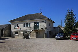 The town hall in Mespuits | |
show Location of Mespuits | |
 Mespuits | |
| Coordinates: 48°21′22″N 2°16′18″E / 48.356°N 2.2717°ECoordinates: 48°21′22″N 2°16′18″E / 48.356°N 2.2717°E | |
| Country | France |
| Region | Île-de-France |
| Department | Essonne |
| Arrondissement | Étampes |
| Canton | Étampes |
| Intercommunality | CA Étampois Sud Essonne |
| Government | |
| • Mayor (2020–2026) | Sabine Furman |
| Area 1 | 9.95 km2 (3.84 sq mi) |
| Population (Jan. 2018)[1] | 214 |
| • Density | 22/km2 (56/sq mi) |
| Time zone | UTC+01:00 (CET) |
| • Summer (DST) | UTC+02:00 (CEST) |
| INSEE/Postal code | 91399 /91150 |
| Elevation | 93–145 m (305–476 ft) |
| 1 French Land Register data, which excludes lakes, ponds, glaciers > 1 km2 (0.386 sq mi or 247 acres) and river estuaries. | |


Mespuits (French pronunciation: [mɛpɥi] (![]() listen)) is a commune in the Essonne department in Île-de-France in northern France.
listen)) is a commune in the Essonne department in Île-de-France in northern France.
Inhabitants of Mespuits are known as Mespuitsiens.
See also[]
References[]
- ^ "Populations légales 2018". INSEE. 28 December 2020.
External links[]
| Wikimedia Commons has media related to Mespuits. |
- Base Mérimée: Search for heritage in the commune, Ministère français de la Culture. (in French)
- Mayors of Essonne Association (in French)
This Essonne geographical article is a stub. You can help Wikipedia by . |
Categories:
- Communes of Essonne
- Essonne geography stubs