Chesterfield Township, Macoupin County, Illinois
Chesterfield Township | |
|---|---|
Township | |
 | |
 Location of Illinois in the United States | |
| Coordinates: 39°13′N 90°5′W / 39.217°N 90.083°WCoordinates: 39°13′N 90°5′W / 39.217°N 90.083°W | |
| Country | United States |
| State | Illinois |
| County | Macoupin |
| Settled | November 1, 1870 |
| Area | |
| • Total | 35.7 sq mi (92 km2) |
| • Land | 35.67 sq mi (92.4 km2) |
| • Water | 0.03 sq mi (0.08 km2) |
| Elevation | 571 ft (174 m) |
| Population (2010) | |
| • Estimate (2016)[1] | 823 |
| • Density | 24/sq mi (9/km2) |
| Time zone | UTC-6 (CST) |
| • Summer (DST) | UTC-5 (CDT) |
| FIPS code | 17-117-13178 |

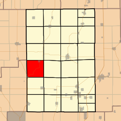
Chesterfield Township (T9N R9W) is located in Macoupin County, Illinois, United States. As of the 2010 census, its population was 855 and it contained 380 housing units.[2]
Geography[]
According to the 2010 census, the township has a total area of 35.7 square miles (92 km2), of which 35.67 square miles (92.4 km2) (or 99.92%) is land and 0.03 square miles (0.078 km2) (or 0.08%) is water.[2]
Demographics[]
| Historical population | |||
|---|---|---|---|
| Census | Pop. | %± | |
| 2016 (est.) | 823 | [1] | |
| U.S. Decennial Census[3] | |||
Adjacent townships[]
- Western Mound Township (north)
- Bird Township (northeast)
- Polk Township (east)
- Hillyard Township (southeast)
- Shipman Township (south)
- Fidelity Township, Jersey County (southwest)
- Ruyle Township, Jersey County (west)
- Rockbridge Township, Greene County (northwest)
References[]
- ^ a b "Population and Housing Unit Estimates". Retrieved June 9, 2017.
- ^ a b "Population, Housing Units, Area, and Density: 2010 - County -- County Subdivision and Place -- 2010 Census Summary File 1". United States Census. Archived from the original on 2020-02-12. Retrieved 2013-05-28.
- ^ "Census of Population and Housing". Census.gov. Retrieved June 4, 2016.
External links[]
Municipalities and communities of Macoupin County, Illinois, United States | ||
|---|---|---|
| Cities |
| |
| Town | ||
| Villages | ||
| Townships | ||
| Unincorporated communities | ||
| Footnotes | ‡This city also has portions in adjacent county or counties | |
| ||
Springfield (capital) | ||
| Topics |
| |
| Regions |
| |
| Municipalities |
| |
| Counties |
| |

This Macoupin County, Illinois location article is a stub. You can help Wikipedia by . |
Categories:
- Townships in Macoupin County, Illinois
- Townships in Illinois
- Metro-East geography stubs