Girard Township, Macoupin County, Illinois
Girard Township | |
|---|---|
Township | |
 | |
 Location of Illinois in the United States | |
| Coordinates: 39°27′N 89°45′W / 39.450°N 89.750°WCoordinates: 39°27′N 89°45′W / 39.450°N 89.750°W | |
| Country | United States |
| State | Illinois |
| County | Macoupin |
| Settled | Unknown |
| Area | |
| • Total | 18.11 sq mi (46.9 km2) |
| • Land | 18.11 sq mi (46.9 km2) |
| • Water | 0 sq mi (0 km2) |
| Elevation | 673 ft (205 m) |
| Population (2010) | |
| • Estimate (2016)[1] | 2,370 |
| • Density | 136.2/sq mi (52.6/km2) |
| Time zone | UTC-6 (CST) |
| • Summer (DST) | UTC-5 (CDT) |
| FIPS code | 17-117-29405 |

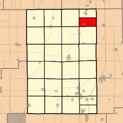
Girard Township (S½ T12N R6W) is located in Macoupin County, Illinois, United States. As of the 2010 census, its population was 2,466 and it contained 1,102 housing units.[2]
History[]
Girard Township is named for Stephen Girard.[3]
Geography[]
According to the 2010 census, the township has a total area of 18.11 square miles (46.9 km2), all land.[2]
Demographics[]
| Historical population | |||
|---|---|---|---|
| Census | Pop. | %± | |
| 2016 (est.) | 2,370 | [1] | |
| U.S. Decennial Census[4] | |||
Adjacent townships[]
- Virden Township (north)
- Bois D'Arc Township, Montgomery County (east)
- Pitman Township, Montgomery County (southeast)
- Nilwood Township (south)
- South Otter Township (southwest)
- North Otter Township (west)
References[]
- ^ a b "Population and Housing Unit Estimates". Retrieved June 9, 2017.
- ^ a b "Population, Housing Units, Area, and Density: 2010 - County -- County Subdivision and Place -- 2010 Census Summary File 1". United States Census. Archived from the original on 2020-02-12. Retrieved 2013-05-28.
- ^ Gannett, Henry (1905). The Origin of Certain Place Names in the United States. Govt. Print. Off. p. 138.
- ^ "Census of Population and Housing". Census.gov. Retrieved June 4, 2016.
External links[]
Municipalities and communities of Macoupin County, Illinois, United States | ||
|---|---|---|
| Cities |
| |
| Town | ||
| Villages | ||
| Townships | ||
| Unincorporated communities | ||
| Footnotes | ‡This city also has portions in adjacent county or counties | |
| ||
Springfield (capital) | ||
| Topics |
| |
| Regions |
| |
| Municipalities |
| |
| Counties |
| |

This Macoupin County, Illinois location article is a stub. You can help Wikipedia by . |
Categories:
- Townships in Macoupin County, Illinois
- Townships in Illinois
- Metro-East geography stubs