Corent
Corent | |
|---|---|
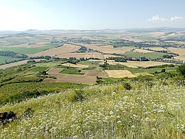 A general view of Corent | |
 Coat of arms | |
show Location of Corent | |
 Corent | |
| Coordinates: 45°40′05″N 3°11′43″E / 45.6681°N 3.1953°ECoordinates: 45°40′05″N 3°11′43″E / 45.6681°N 3.1953°E | |
| Country | France |
| Region | Auvergne-Rhône-Alpes |
| Department | Puy-de-Dôme |
| Arrondissement | Clermont-Ferrand |
| Canton | Les Martres-de-Veyre[1] |
| Government | |
| • Mayor (2020–2026) | Thierry Julien[2] |
| Area 1 | 2.68 km2 (1.03 sq mi) |
| Population (Jan. 2018)[3] | 766 |
| • Density | 290/km2 (740/sq mi) |
| Time zone | UTC+01:00 (CET) |
| • Summer (DST) | UTC+02:00 (CEST) |
| INSEE/Postal code | 63120 /63730 |
| Elevation | 330–610 m (1,080–2,000 ft) (avg. 500 m or 1,600 ft) |
| 1 French Land Register data, which excludes lakes, ponds, glaciers > 1 km2 (0.386 sq mi or 247 acres) and river estuaries. | |


Corent is a commune in the Puy-de-Dôme department in Auvergne-Rhône-Alpes in central France.
It sits approximately 2 miles north of Les Martres-de-Veyre on the side of the old volcanic Puy de Corent.
In 2001 excavation began on a Gaul and later Roman Oppidum found in a field atop the puy. To this date, vast quantities of land have been excavated revealing the site as a main political, religious and economic center.[4]
See also[]
References[]
- ^ "Décret 2014-210 du 21 février 2014 portant délimitation des cantons dans le département du Puy-de-Dôme" [2014-210 decree delimiting cantons of Puy-de-Dôme department]. Légifrance (in French). 21 February 2014. Retrieved 27 November 2016.
- ^ "Répertoire national des élus: les maires". data.gouv.fr, Plateforme ouverte des données publiques françaises (in French). 2 December 2020. Retrieved 7 December 2020.
- ^ "Populations légales 2018". INSEE. 28 December 2020.
- ^ Fouilles de Corent
| Wikimedia Commons has media related to Corent. |
| show Authority control |
|---|
This Puy-de-Dôme geographical article is a stub. You can help Wikipedia by . |
Categories:
- Former populated places in France
- Communes of Puy-de-Dôme
- Puy-de-Dôme geography stubs