Gignac, Vaucluse
Gignac | |
|---|---|
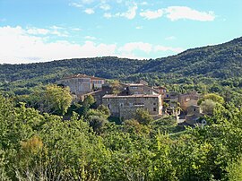 The village of Gignac | |
 Coat of arms | |
show Location of Gignac | |
 Gignac | |
| Coordinates: 43°55′12″N 5°31′39″E / 43.92°N 5.5275°ECoordinates: 43°55′12″N 5°31′39″E / 43.92°N 5.5275°E | |
| Country | France |
| Region | Provence-Alpes-Côte d'Azur |
| Department | Vaucluse |
| Arrondissement | Apt |
| Canton | Apt |
| Government | |
| • Mayor (2020–2026) | Sylvie Pasquini[1] |
| Area 1 | 8.15 km2 (3.15 sq mi) |
| Population (Jan. 2018)[2] | 69 |
| • Density | 8.5/km2 (22/sq mi) |
| Time zone | UTC+01:00 (CET) |
| • Summer (DST) | UTC+02:00 (CEST) |
| INSEE/Postal code | 84048 /84400 |
| Elevation | 366–834 m (1,201–2,736 ft) (avg. 450 m or 1,480 ft) |
| 1 French Land Register data, which excludes lakes, ponds, glaciers > 1 km2 (0.386 sq mi or 247 acres) and river estuaries. | |


Gignac (French pronunciation: [ʒiɲak]; Occitan: Ginhac) is a commune in the Vaucluse department in the Provence-Alpes-Côte d'Azur region in southeastern France. Chateau d'Autet lies to the northeast of the village. A beautifully restored 18th century chateau and official historical landmark,[3] the Chateau de Gignac, sits atop a hill overlooking the hamlet of Gignac. An earlier chateau at this location was damaged in 1575 during the French Wars of Religion, and was rebuilt between 1760 and 1780 on the eve of the French Revolution.[3]
See also[]
- Communes of the Vaucluse department
References[]
- ^ "Répertoire national des élus: les maires". data.gouv.fr, Plateforme ouverte des données publiques françaises (in French). 2 December 2020. Retrieved 7 December 2020.
- ^ "Populations légales 2018". INSEE. 28 December 2020.
- ^ Jump up to: a b "Château à Gignac - PA84000012 - Monumentum". monumentum.fr. Retrieved 2021-03-05.
| Wikimedia Commons has media related to Gignac, Vaucluse. |
| show Authority control |
|---|
This Vaucluse geographical article is a stub. You can help Wikipedia by . |
Categories:
- Communes of Vaucluse
- Vaucluse geography stubs