Sorgues
Sorgues
Sòrgas (Occitan) | |
|---|---|
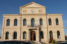 Former Sorgues Town Hall | |
 Coat of arms | |
show Location of Sorgues | |
 Sorgues | |
| Coordinates: 44°00′33″N 4°52′23″E / 44.0092°N 4.873°ECoordinates: 44°00′33″N 4°52′23″E / 44.0092°N 4.873°E | |
| Country | France |
| Region | Provence-Alpes-Côte d'Azur |
| Department | Vaucluse |
| Arrondissement | Avignon |
| Canton | Sorgues |
| Government | |
| • Mayor (2020–2026) | Thierry Lagneau[1] |
| Area 1 | 33.4 km2 (12.9 sq mi) |
| Population (Jan. 2018)[2] | 18,802 |
| • Density | 560/km2 (1,500/sq mi) |
| Time zone | UTC+01:00 (CET) |
| • Summer (DST) | UTC+02:00 (CEST) |
| INSEE/Postal code | 84129 /84700 |
| Elevation | 14–114 m (46–374 ft) (avg. 30 m or 98 ft) |
| 1 French Land Register data, which excludes lakes, ponds, glaciers > 1 km2 (0.386 sq mi or 247 acres) and river estuaries. | |


Sorgues (French pronunciation: [sɔʁɡ]; Occitan: Sòrgas) is a commune in the Vaucluse department in the Provence-Alpes-Côte d'Azur region of Southeastern France. The river Ouvèze, a tributary of the Rhône, as well as its tributary Sorgue, which begins at the Fontaine de Vaucluse, run through the commune.[3][4] Sorgues, which had a population of 18,680 in 2017, is located just north of Avignon, on the border with Gard.
History[]
According to The Autobiography of Alice B. Toklas by Gertrude Stein, Georges Braque lived in Sorgues after being wounded during the First World War.[5]
See also[]
- Communes of the Vaucluse department
- Châteauneuf-du-Pape AOC
References[]
- ^ "Répertoire national des élus: les maires". data.gouv.fr, Plateforme ouverte des données publiques françaises (in French). 2 December 2020. Retrieved 7 December 2020.
- ^ "Populations légales 2018". INSEE. 28 December 2020.
- ^ Sandre. "Fiche cours d'eau - L'Ouvèze (V6--0200)".
- ^ Sandre. "Fiche cours d'eau - La Sorgue de Velleron (V6150500)".
- ^ Gertrude Stein, The Autobiography of Alice B. Toklas, Penguin Classics; New Ed edition (26 April 2001), page 201
| Wikimedia Commons has media related to Sorgues. |
| show Authority control |
|---|
Categories:
- Communes of Vaucluse