Sérignan-du-Comtat
Sérignan-du-Comtat | |
|---|---|
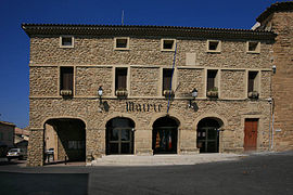 The town hall of Sérignan-du-Comtat | |
 Coat of arms | |
show Location of Sérignan-du-Comtat | |
 Sérignan-du-Comtat | |
| Coordinates: 44°11′24″N 4°50′39″E / 44.19°N 4.8442°ECoordinates: 44°11′24″N 4°50′39″E / 44.19°N 4.8442°E | |
| Country | France |
| Region | Provence-Alpes-Côte d'Azur |
| Department | Vaucluse |
| Arrondissement | Carpentras |
| Canton | Bollène |
| Intercommunality | Aygues Ouvèze en Provence |
| Government | |
| • Mayor (2020–2026) | Julien Merle |
| Area 1 | 19.82 km2 (7.65 sq mi) |
| Population (Jan. 2018)[1] | 2,764 |
| • Density | 140/km2 (360/sq mi) |
| Time zone | UTC+01:00 (CET) |
| • Summer (DST) | UTC+02:00 (CEST) |
| INSEE/Postal code | 84127 /84830 |
| Elevation | 53–240 m (174–787 ft) (avg. 80 m or 260 ft) |
| 1 French Land Register data, which excludes lakes, ponds, glaciers > 1 km2 (0.386 sq mi or 247 acres) and river estuaries. | |


Sérignan-du-Comtat is a commune in the Vaucluse department in the Provence-Alpes-Côte d'Azur region in southeastern France.
Points of interest[]
- Harmas de Fabre
- Musée-Atelier Werner Lichtner-Aix [2]
See also[]
- Communes of the Vaucluse department
References[]
- ^ "Populations légales 2018". INSEE. 28 December 2020.
- ^ http://musee-lichtner-aix.com/
| Wikimedia Commons has media related to Sérignan-du-Comtat. |
| show Authority control |
|---|
This Vaucluse geographical article is a stub. You can help Wikipedia by . |
Categories:
- Communes of Vaucluse
- Vaucluse geography stubs