Puyméras
Puyméras | |
|---|---|
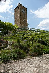 The clock tower in Puyméras | |
 Coat of arms | |
show Location of Puyméras | |
 Puyméras | |
| Coordinates: 44°16′14″N 5°07′44″E / 44.2706°N 5.1289°ECoordinates: 44°16′14″N 5°07′44″E / 44.2706°N 5.1289°E | |
| Country | France |
| Region | Provence-Alpes-Côte d'Azur |
| Department | Vaucluse |
| Arrondissement | Carpentras |
| Canton | Vaison-la-Romaine |
| Intercommunality | Vaison Ventoux |
| Government | |
| • Mayor (2020–2026) | Roger Trappo[1] |
| Area 1 | 14.59 km2 (5.63 sq mi) |
| Population (Jan. 2018)[2] | 587 |
| • Density | 40/km2 (100/sq mi) |
| Time zone | UTC+01:00 (CET) |
| • Summer (DST) | UTC+02:00 (CEST) |
| INSEE/Postal code | 84094 /84110 |
| Elevation | 275–846 m (902–2,776 ft) (avg. 372 m or 1,220 ft) |
| 1 French Land Register data, which excludes lakes, ponds, glaciers > 1 km2 (0.386 sq mi or 247 acres) and river estuaries. | |


Puyméras (French pronunciation: [pɥimeʁa];[3][4][5] Occitan: Puègmeiràs) is a commune in the Vaucluse department in the Provence-Alpes-Côte d'Azur region in southeastern France.
Main sights[]
- Church of St. Michael, originally built in Romanesque style
- Clock Tower, remade in the 18th century
- Castle, ruined during the French Revolution
- 14th century defensive walls, with a circular tower near the Sabrun Gate
See also[]
- Communes of the Vaucluse department
References[]
- ^ "Répertoire national des élus: les maires". data.gouv.fr, Plateforme ouverte des données publiques françaises (in French). 2 December 2020. Retrieved 7 December 2020.
- ^ "Populations légales 2018". INSEE. 28 December 2020.
- ^ Restaurant Le Girocedre à Puyméras, retrieved 2021-07-18
- ^ Puyméras, retrieved 2021-07-18
- ^ Paroles de producteurs #4 - Cave de Puyméras, retrieved 2021-07-18
| Wikimedia Commons has media related to Puyméras. |
| show Authority control |
|---|
This Vaucluse geographical article is a stub. You can help Wikipedia by . |
Categories:
- Communes of Vaucluse
- Vaucluse geography stubs