Ham-sous-Varsberg
From Wikipedia, the free encyclopedia
For other uses, see Ham (disambiguation).
Commune in Grand Est, France
Ham-sous-Varsberg | |
|---|---|
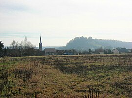 St Lambert's Church and the castle | |
 Coat of arms | |
 Ham-sous-Varsberg  Ham-sous-Varsberg | |
Coordinates:  49°10′54″N 6°38′54″E / 49.1817°N 6.6483°E / 49.1817; 6.6483Coordinates: 49°10′54″N 6°38′54″E / 49.1817°N 6.6483°E / 49.1817; 6.6483 49°10′54″N 6°38′54″E / 49.1817°N 6.6483°E / 49.1817; 6.6483Coordinates: 49°10′54″N 6°38′54″E / 49.1817°N 6.6483°E / 49.1817; 6.6483 | |
| Country | France |
| Region | Grand Est |
| Department | Moselle |
| Arrondissement | Forbach-Boulay-Moselle |
| Canton | Boulay-Moselle |
| Intercommunality | |
| Government | |
| • Mayor (2020–2026) | Edmond Bettinger |
| Area 1 | 6.53 km2 (2.52 sq mi) |
| Population (Jan. 2018)[1] | 2,831 |
| • Density | 430/km2 (1,100/sq mi) |
| Time zone | UTC+01:00 (CET) |
| • Summer (DST) | UTC+02:00 (CEST) |
| INSEE/Postal code | 57288 /57880 |
| Elevation | 213–332 m (699–1,089 ft) (avg. 220 m or 720 ft) |
| 1 French Land Register data, which excludes lakes, ponds, glaciers > 1 km2 (0.386 sq mi or 247 acres) and river estuaries. | |

Ham-sous-Varsberg (German: Hamm unter Varsberg) is a commune in the Moselle department in Grand Est in north-eastern France.
See also[]
References[]
- ^ "Populations légales 2018". INSEE. 28 December 2020.
| Wikimedia Commons has media related to Ham-sous-Varsberg. |
show
| |
|---|---|
| Prefecture |
|
| Subprefectures |
|
| Other |
|
This Arrondissement of Forbach-Boulay-Moselle geographical article is a stub. You can help Wikipedia by . |
- v
- t
Retrieved from ""
Categories:
- Communes of Moselle (department)
- Forbach-Boulay-Moselle arrondissement geography stubs
Hidden categories:
- Articles with short description
- Short description is different from Wikidata
- Infobox mapframe without OSM relation ID on Wikidata
- Coordinates on Wikidata
- Pages using infobox settlement with image map1 but not image map
- Articles containing German-language text
- Commons category link from Wikidata
- Articles with GND identifiers
- Articles with VIAF identifiers
- Articles with BNF identifiers
- Articles with MusicBrainz area identifiers
- Articles with WorldCat-VIAF identifiers
- All stub articles
- Pages using the Kartographer extension