Highways in the Czech Republic


Highways in the Czech Republic are managed by the state-owned Road and Motorway Directorate of the Czech Republic – ŘSD ČR, established in 1997. The ŘSD currently (2018) manages and maintains 1,250 km of motorways (dálnice), whose speed limit is of 130 km/h or 80 mph (or 80 km/h or 50 mph within a town). The present-day national motorway network is due to be of about 2,000 km before 2030.[1]
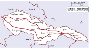
Network map[]

Toll requirements[]


Motorcars up to 3.5 tonnes[]
In 2018, for motorcars with a maximum authorized mass of up to 3.5 tonnes, motorways in the Czech Republic (with some exceptions, see below) are subject to a time-based fee (časový poplatek) paid with the purchase of a windscreen toll vignette (dálniční známka or dálniční kupón) with a validity of either 10 days (310 CZK), 1 month (440 CZK) or 1 year (valid from 1 December 2017 to 31 January 2019) (1500 CZK).
Generally said, a motorway road sign ![]() means that a toll vignette (windscreen label) is obligatory (usually not immediately from the border on). Only sections not subject to vignette are designated with an additional road sign (see below).
means that a toll vignette (windscreen label) is obligatory (usually not immediately from the border on). Only sections not subject to vignette are designated with an additional road sign (see below).
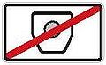
A road sign indicating that a motorway sections is not subject to vignette. ≤ 3.5t (usually placed under the road sign for motorway
 )
)

A road sign indicating the beginning of the motorway vignette (toll label) duty for cars ≤ 3.5t (usually placed under the road sign for the motorway after the end of toll-free section
)


For 2018, the following motorway sections are subject to the time-based fee for motor cars up to 3.5 t:[2]
| Motorway route subject to a time-based fee (compulsory toll vignette) | mk L [clarification needed] | |
|---|---|---|
| Modletice (exit 76) – Prague-Slivenec (exit 16) | 3 | |
| Prague-Chodov (exit 2) – Kývalka (exit 182) | 08 | |
| Holubice (exit 210) – Kroměříž-západ (exit 258) | 8 | |
| Kroměříž-východ (exit 260) – Říkovice (exit 272) | 12 | |
| Lipník nad Bečvou (exit 298) – Ostrava-Rudná (exit 354) | 58 | |
| Brno-Chrlice (exit 3) – border with Slovakia (exit 61)
– in the direction from Slovakia subject to a charge from km 55.5 (rest area Lanžhot) |
58 | |
| Mezno (exit 62) – Čekanice (exit 76) | 14 | |
| Měšice (exit 79) – Veselí nad Lužnicí, sever (exit 104) | 5 | |
| Jíloviště (exit 9) – Háje (exit 45) | 36 | |
| Prague-Třebonice (exit 1) – Beroun-východ (exit 14) | 14 | |
| Beroun-západ (exit 22) – Ejpovice (exit 67) | 45 | |
| Sulkov (exit 89) – border with Germany (exit 151)
– in the direction from Germany subject to a charge from km 149.7 (rest area Rozvadov) |
62 | |
| Jeneč (exit 7) – Nové Strašecí (exit 32)
- from Cheb to Karlovy Vary as of 2018 without vignette |
25 | |
| Kněževes (exit 3) – Knovíz (exit 18) | 15 | |
| Zdiby (exit 1) – Řehlovice (exit 65) | 65 | |
| Knínice (exit 80) – border with Germany (exit 92)
– in the direction from Germany subject to a charge from exit 65 Řehlovice |
12 | |
| Stará Boleslav (exit 14) – Bezděčín (exit 39) | 25 | |
| Kosmonosy (exit 46) – Ohrazenice (exit 71) | 25 | |
| Jirny (exit 8) – Hradec Králové-Kukleny (exit 90) | 82 | |
| Sedlice (exit 126) – Opatovice (exit 129) | ||
| Mohelnice-jih (exit 235) – Křelov (exit 261) | 26 | |
| Olomouc-Holice (exit 276) – Lipník nad Bečvou (exit 296) | 20 | |
| Vyškov-východ (exit 1) – Prostějov-jih (exit 21) | 19 | |
| Držovice (exit 26) – Olomouc-Slavonín (exit 39) | 11 | |
| Bělotín (exit 1) – Bělotín-východ (exit 3) | ||
| Frýdek-Místek (exit 47) – Žukov (exit 70) | 19 | |
| Rajhrad (exit 10) – Pohořelice-jih (exit 26) | 13 | |
| Hulín (exit 16) – Otrokovice (exit 32) | 14 | |
| Ostrava-Hrabová, průmyslová zóna (exit 40) – Frýdek-Místek (exit 51) | 12 |
Vehicles over 3.5 tonnes[]
As of 1 January 2007 a new system of electronic toll aka a distance toll for vehicles with a weight exceeding 12 tons has been introduced for motorways and some roads of the first class (silnice první třídy), totally cca 200 km.[3] As of 1 January 2010, this applies also to vehicles over 3.5 tons. There is an ongoing public discussion on imposition of electronic toll for all cars and vehicles.

A road sign informing of the beginning of the electronic toll duty for vehicles > 3.5t

A road sign informing of the beginning of both motorway vignette (toll label) and electronic toll duty

A road sign informing of the motorway section subject to neither motorway vignette (toll label) nor electronic toll duty


History of Czech motorways[]
Before the Second World War[]


The first informal plan for a motorway (first called in Czech autostráda or dálková silnice) in Czechoslovakia date back to 1935. This was to link Prague through Slovakia with the easternmost Czechoslovak territory, Carpathian Ruthenia (now Zakarpattia Oblast in Ukraine). The terminus was to be at Velykyy Bychkiv (Velký Bočkov in Czech) on the Romanian border. The definitive route, including a Prague ring motorway, was approved shortly after the Munich Agreement on 4 November 1938, with a planned speed limit of 120 km/h.
The Nazi authorities also made the second Czecho-Slovak Republic, already a German satellite state, build a part of the Reichsautobahn Breslau - Vienna as an extraterritorial German motorway with border checkpoints at each motorway exit. However, only a construction of the route within Bohemia and Moravia was initiated, but never finished. It still sporadically appears in some current Czech motorway plans.
On 1 December 1938 Nazi Germany had already initiated a construction of the so-called Sudetenautobahn (in Sudetenland, before the Munich agreement part of Czechoslovakia, then of Germany) in the route Streitau (Bavaria) – Eger – Carlsbad – Lobositz – Böhmisch Leipa – Reichenberg (capital of Sudetenland) – Görlitz (in Prussia, now in Saxony). The autobahn has never been finished, but some remnants in the landscape close to Pomezí nad Ohří, Cheb/Eger and Liberec/Reichenberg are still prominent and an unfinished part from Svárov via Machnín to Chrastava was used in the construction of the I/35 road.
Nazi occupation[]
Czechoslovakia was broken up with a declaration of independence by the Slovak Republic and by the short-lived Carpatho-Ukraine which was a prelude to the German occupation of Bohemia and Moravia on 15 March 1939. It was decided to build the motorway only as far as the Slovak border. The technical parameters of motorways (speed limit of 140 – 160 km/h) were adjusted to those of the German Reichsautobahn, as Czech (Bohemian-Moravian) motorways were to be integrated within the German Reichsautobahn network.
The project for the first segment Prague - Lužná was ready in January 1939, and construction in Moravia began on 24 January in Chřiby on the Zástřizly - Lužná segment. The construction in Bohemia from Prague began on 2 May 1939, with a switch to right-hand traffic in Bohemia and Moravia having already gone without a hitch. The motorway should have reached Brno in 1940, but building materials and labour shortages due to an absolute priority given to the Nazi armament industry delayed the work considerably. The construction in the route of approx. 77 km from Prague towards Brno advanced notably, but a prohibition of all civil constructions by the German authorities came into force in 1942.
After the Second World War[]
After the Second World War, the completion of only the first and unfinished 77 km of the motorway Prague – Brno as far as Humpolec was approved by the Government in November 1945 and was reinaugurated in 1946. The part-built construction sites of the Sudetenautobahn (28 km) were completely abandoned, as well as that of the Breslau – Vienna motorway (84 km). The latter was, however, incorporated in some plans as a future connection motorway between Brno and the D35 motorway. The 77 km of the Prague – Humpolec motorway had been completed except for some large bridges and a concrete surface when the new communist government decided to discontinue the work completely in early 1950.
Only on 8 August 1967 the Government of the Socialist Republic of Czechoslovakia resolved to continue the construction of motorways by adopting a new motorway plan for the whole country and resolved to continue the already twice interrupted construction of the motorway Prague - Brno (number D1) and further Brno - Bratislava (D2). The construction was solemnly inaugurated on 8 September 1967. Due to a change of technical parameters, some bridges finished before 1950 were replaced. The Prague - Brno motorway (D1), initiated on 2 May 1939, reached Brno in 1980, a full 40 years after the originally scheduled opening.
The pace of construction of highways has always been rather slow up to the present day. The first 100 km of highways on the territory of today's Czech Republic were completed in 1975, 500 km in 1985 and 1,000 km in 2007. Funding for the construction of highways was radically reduced after the financial crisis in 2008 due to draconian budget cuts, and is currently gaining momentum rather slowly for various reasons.
Motorways[]

The motorways in the Czech Republic, Czech: dálnice (abbr. D), are defined as two-lane motorways in each direction, with an emergency lane. The speed limit is 130 km/h or 80 mph. Their highway shields are white on red and road signs are white on green. As of 1 January 2016, the Czech motorway network comprises 18 motorways. Nowadays, 17 of them are at least partially operational, but only 5 (D2, D5, D8, D10 and D46) have been completed, another two (D1 and D56) are near completion, D56 in February 2022[4] and D1 by the end of 2024,[5] by outer source in October 2022.[6]
The number of a motorway reflects a number of the previous national road alongside which it was built up or which it shall replace. After the construction of the motorway, the affected national road is degraded to a regional road with a number beginning on 6 and having 3 digits. For instance, after the completion of the D8 motorway (Prague - Lovosice), the previous national road no. I/8 between Prague and Lovosice became a regional road no. 608. Regional roads are maintained by the self-governing regions (kraj) and not by the state directly.
| Name of motorway | Motorway route | Operational (km)[7] |
% operational |
In construction (km) |
Planned Total length (km) |
Maximum AADT | |
|---|---|---|---|---|---|---|---|
| D0 | Prague Ring (Pražský okruh) | 41 | 49% | 83 | 75,092 | ||
| D1 | Prague – Jihlava – Brno – Vyškov – Hulín – Přerov – Lipník nad Bečvou – Bělotín – Ostrava – Bohumín – |
367 | 98% | 376 | 99,265 | ||
| D2 | Brno – Břeclav – |
61 | 100% | 61 | 50,905 | ||
| D3 | Prague – Tábor – České Budějovice – Dolní Dvořiště – |
66 | 41% | 19,8 | 168 | 14,097 | |
| D4 | Prague – Příbram – Háje | 54 | 63% | 32 | 86 | 29,617 | |
| D5 | Via Carolina (Prague – Beroun – Rokycany – Plzeň – Rozvadov – |
151 | 100% | 151 | 58,760 | ||
| D6 | Prague – Karlovy Vary – Sokolov – Cheb – Pomezí nad Ohří – |
98 | 58% | 4,9 | 169 | 39,449 | |
| D7 | Prague – Louny – Chomutov | 45 | 55% | 9,6 | 82 | 33,479 | |
| D8 | Prague – Lovosice – Ústí nad Labem – – |
96 | 100% | 96 | 48,003 | ||
| D10 | Prague – Mladá Boleslav – Turnov | 71 | 100% | 71 | 43,430 | ||
| D11 | Prague – Poděbrady – Hradec Králové – Jaroměř – Trutnov – Královec – |
91 | 60% | 22,4 | 154 | 43,986 | |
| D35 | Hradec Králové – Svitavy – Mohelnice – Olomouc – Lipník nad Bečvou | 66 | 31% | 27,3 | 210 | 34,055 | |
| D46 | Vyškov – Prostějov – Olomouc | 38 | 100% | 38 | 36,136 | ||
| D48 | Bělotín – Nový Jičín – Frýdek-Místek – Český Těšín | 37 | 47% | 21,8 | 79 | 18,642 | |
| D49 | Hulín – Zlín – Vizovice – Střelná – |
0 | 0% | 69 | |||
| D52 | Brno – Pohořelice – Mikulov – |
17 | 32% | 45 | 23,535 | ||
| D55 | Olomouc – Přerov – Hulín – Otrokovice – Hodonín – Břeclav | 16 | 17% | 11,4 | 101 | 16,102 | |
| D56 | Ostrava – Frýdek-Místek | 12 | 85% | 2,2 | 14 | 24,957 | |
| Total | 1317 | 63% | 119,2 | 2122 |
Originally, a motorway D47 was planned from Brno to Ostrava and construction in the section Lipník nad Bečvou - Ostrava under this number even started, but in the end the ŘSD in 2006 decided that the D47 should be classified as an extension of the D1 motorway.
Roads for motorcars[]

The category of roads for motorcars (Silnice pro motorová vozidla) was changed on 31 December 2015. Most roads for motorcars were classified as fully fledged motorways, while some sections remained in the same category. The speed limit for most existing roads for motorcars was reduced to 110 km/h.
As of 2016, roads for motorcars are not subject to highway tolls for vehicles with total weight up to 3.5 t. The signs on roads for motorcars consist of white text on a blue background, like on other common roads and unlike on motorways, where the background is green. Exits, like on motorways, are usually numbered.
It is in the jurisdiction of individual regions (kraje) to decide whether roads for motorcars should have higher speed limits than regular roads. An example of this is the expressway R35 between Liberec and Turnov which has not been classified as of 1 January 2016 as a motorway but an exceptional speed limit of up to 130 km/h was kept using road signs.
List of completed roads for motorcars[]
| Name | Route | |
|---|---|---|
| Městský okruh Praha MO (previously I/29)(Prague City Ring) |
Rybníčky – Krč – Braník – Smíchov – Břevnov – Troja | |
| Chodovská radiála I/8 (Chodov Trunk Road in Prague) | Pankrác - Chodov (motorway | |
| Radlická radiála I/5 (Radlice Trunk Road in Prague) | Bucharova St. - Třebonice (motorway | |
| Vysočanská radiála I/10 (Vysočany Trunk Road in Prague) | Kbelská St.- Satalice (motorway | |
| Štěrboholská spojka I/12 (Štěrboholy Trunk Road in Prague) | Rybníčky - Běhochovice (motorway | |
| Spořilovská spojka (Spořilov Trunk Road in Prague) | Chodovská St.- Chodov (motorway | |
| I/6 | Dvory – Jenišov (motorway | |
| I/7 | Spořice (motorway | |
| I/10 | Ohrazenice (motorway | |
| I/11 | Mokré Lazce - Ostrava-Krásné Pole | |
| I/20 | Nová Hospoda (motorway | |
| I/23 | Brno-západ (motorway | |
| I/26 | Plzeň-K Fořtovně St.- Ejpovice (motorway | |
| I/27 | Plzeň-Dobřanská St.(motorway | |
| I/35 | Liberec-Hodkovická St.- Ohrazenice (motorway | |
| I/35 | Křelov - Olomouc | |
| I/37 | Hradec Králové – Pardubice | |
| I/43 | Česká – Brno-Křižíkova St. | |
| I/44 | Vlachov - Rájec, Postřelmov ring road | |
| I/48 | Český Těšín (motorway | |
| I/50 | Brno-Gajdošova St.– Brno-východ (motorway | |
| I/63 | Bystřany - Řehlovice (motorway |
Planned upgrade to road for motorcars:
- I/7 Spořice - Křimov
- I/13 Chomutov - Teplice (some parts)
- I/13 Ostrov - Karlovy Vary
- I/11 Ostrava-Vítkovice - Šenov
- I/14 Liberec: interchange I/35 - roundabout Kunratice (direction Jablonec n. N.)
- I/34 České Budějovice - Lišov, interchange Na Klaudě St. (after completion of the interchange Úsilné between motorway D3 and I/34)
- I/35 roundabout Hrádek nad Nisou - Liberec, interchange Hodkovická St.(inc. border road, only a single carriageway road)[8]
Opening of new motorways[]
This section needs to be updated. (January 2021) |
Construction of new motorways in recent years has been hampered due to corruption scandals and austerity measures as well as owing to new European rules under which old EIA assessments lapsed. See the table below.[9] However, this should improve slightly in next years. By the end of 2017, there were 58.2 km of new motorways under construction, in 2018 a construction of further 130.3 km should be initiated (apart from the ongoing reconstruction of the motorway D1).[10] Nonetheless, only 18.1 km of new motorways may open to public in 2018, 18.8 km in 2019 and 29.7 in 2020.
Between 1971 and 2014 the average year pace of completion of new highways was 28.2 km a year.[11]
| From | To | Length | Construction started | Due to open | Remarks | |
|---|---|---|---|---|---|---|
| Řevničov | ring road | 4.2 km | 07/2017 | 10/2020 | ||
| Nové Strašecí | Řevničov | 5.6 km | 08/2017 | 10/2020 | ||
| Lubenec | ring road | 4.9 km | 03/2018 | 06/2021 | ||
| Rybí | Rychaltice | 11.5 km | 03/2017 | 12/2020 |
See also[]
References[]
- ^ "České dálnice". Ceskedalnice.cz. Retrieved 2019-05-09.
- ^ "České dálnice | Dálniční známky". www.ceskedalnice.cz. Retrieved 2017-01-03.
- ^ "Toll map". www.mytocz.eu. Archived from the original (GIF) on 2018-08-30. Retrieved 2019-05-09.
- ^ "České dálnice | Dálnice D56".
- ^ "České dálnice | Úseky ve výstavbě".
- ^ "České dálnice | Dálnice D1".
- ^ https://www.rsd.cz/wps/portal/web/Silnice-a-dalnice/delky-a-dalsi-data-komunikaci Øeditelství silnic a dálnic ÈR: Délky a další data komunikací
- ^ "forum.ceskedalnice.cz". forum.ceskedalnice.cz. Retrieved 2016-01-21.
- ^ "České dálnice | Úseky ve výstavbě". Ceskedalnice.cz. Retrieved 2019-05-09.
- ^ "Archived copy". Archived from the original on 2016-10-11. Retrieved 2016-10-11.CS1 maint: archived copy as title (link)
- ^ "Souhrnná data zprovozňování dálnic (vč. původně rychlostních silnic) v České republice" (PDF). www.ceskedalnice.cz (in Czech). Retrieved 2019-05-09.
External links[]
| Wikimedia Commons has media related to Highways in the Czech Republic. |
| hide Highways in the Czech Republic | ||
|---|---|---|
| Authority control: National libraries |
|---|
- Motorways in the Czech Republic
- Transport in the Czech Republic