Hunting, Moselle
Hunting | |
|---|---|
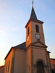 The church in Hunting | |
 Coat of arms | |
show Location of Hunting | |
 Hunting | |
| Coordinates: 49°24′53″N 6°19′40″E / 49.4147°N 6.3278°ECoordinates: 49°24′53″N 6°19′40″E / 49.4147°N 6.3278°E | |
| Country | France |
| Region | Grand Est |
| Department | Moselle |
| Arrondissement | Thionville |
| Canton | Bouzonville |
| Intercommunality | Bouzonvillois-Trois Frontières |
| Government | |
| • Mayor (2020–2026) | Norbert Marck[1] |
| Area 1 | 3.78 km2 (1.46 sq mi) |
| Population (Jan. 2018)[2] | 711 |
| • Density | 190/km2 (490/sq mi) |
| Time zone | UTC+01:00 (CET) |
| • Summer (DST) | UTC+02:00 (CEST) |
| INSEE/Postal code | 57341 /57480 |
| Elevation | 160–267 m (525–876 ft) (avg. 308 m or 1,010 ft) |
| 1 French Land Register data, which excludes lakes, ponds, glaciers > 1 km2 (0.386 sq mi or 247 acres) and river estuaries. | |


Hunting (German: Hüntingen; Lorraine Franconian: Hënténgen/Hënténg) is a commune in the Moselle department in Grand Est in north-eastern France.
Population[]
| Year | Pop. | ±% |
|---|---|---|
| 1962 | 285 | — |
| 1968 | 278 | −2.5% |
| 1975 | 288 | +3.6% |
| 1982 | 474 | +64.6% |
| 1990 | 580 | +22.4% |
| 1999 | 566 | −2.4% |
| 2006 | 579 | +2.3% |
| 2010 | 645 | +11.4% |
See also[]
| Wikimedia Commons has media related to Hunting (Moselle). |
References[]
- ^ "Répertoire national des élus: les maires". data.gouv.fr, Plateforme ouverte des données publiques françaises (in French). 2 December 2020.
- ^ "Populations légales 2018". INSEE. 28 December 2020.
Categories:
- Communes of Moselle (department)
- Thionville arrondissement geography stubs