Kappelkinger
Kappelkinger | |
|---|---|
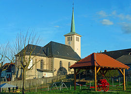 The church in Kappelkinger | |
 Coat of arms | |
show Location of Kappelkinger | |
 Kappelkinger | |
| Coordinates: 48°58′19″N 6°54′36″E / 48.9719°N 6.91°ECoordinates: 48°58′19″N 6°54′36″E / 48.9719°N 6.91°E | |
| Country | France |
| Region | Grand Est |
| Department | Moselle |
| Arrondissement | Sarreguemines |
| Canton | Sarralbe |
| Intercommunality | |
| Government | |
| • Mayor (2020–2026) | Bertrand Potié[1] |
| Area 1 | 8.58 km2 (3.31 sq mi) |
| Population (Jan. 2018)[2] | 401 |
| • Density | 47/km2 (120/sq mi) |
| Time zone | UTC+01:00 (CET) |
| • Summer (DST) | UTC+02:00 (CEST) |
| INSEE/Postal code | 57357 /57430 |
| Elevation | 213–247 m (699–810 ft) (avg. 260 m or 850 ft) |
| 1 French Land Register data, which excludes lakes, ponds, glaciers > 1 km2 (0.386 sq mi or 247 acres) and river estuaries. | |


Kappelkinger is a commune in the Moselle department in Grand Est in north-eastern France.
Localities of the commune: Uberkinger, Kohlplatz.
Population[]
| Year | Pop. | ±% |
|---|---|---|
| 2005 | 398 | — |
| 2006 | 391 | −1.8% |
| 2007 | 397 | +1.5% |
| 2008 | 398 | +0.3% |
| 2009 | 398 | +0.0% |
| 2010 | 399 | +0.3% |
| 2011 | 404 | +1.3% |
| 2012 | 410 | +1.5% |
| 2013 | 408 | −0.5% |
| 2014 | 406 | −0.5% |
| 2015 | 404 | −0.5% |
| 2016 | 401 | −0.7% |
See also[]
| Wikimedia Commons has media related to Kappelkinger. |
References[]
- ^ "Répertoire national des élus: les maires". data.gouv.fr, Plateforme ouverte des données publiques françaises (in French). 2 December 2020.
- ^ "Populations légales 2018". INSEE. 28 December 2020.
| show Authority control |
|---|
Categories:
- Communes of Moselle (department)
- Sarreguemines arrondissement geography stubs