Kuntzig
Kuntzig | |
|---|---|
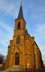 The church in Kuntzig | |
 Coat of arms | |
show Location of Kuntzig | |
 Kuntzig | |
| Coordinates: 49°20′49″N 6°14′29″E / 49.3469°N 6.2414°ECoordinates: 49°20′49″N 6°14′29″E / 49.3469°N 6.2414°E | |
| Country | France |
| Region | Grand Est |
| Department | Moselle |
| Arrondissement | Thionville |
| Canton | Metzervisse |
| Intercommunality | |
| Government | |
| • Mayor (2020–2026) | Patrick Becker[1] |
| Area 1 | 4.51 km2 (1.74 sq mi) |
| Population (Jan. 2018)[2] | 1,355 |
| • Density | 300/km2 (780/sq mi) |
| Time zone | UTC+01:00 (CET) |
| • Summer (DST) | UTC+02:00 (CEST) |
| INSEE/Postal code | 57372 /57970 |
| Elevation | 161–200 m (528–656 ft) (avg. 150 m or 490 ft) |
| 1 French Land Register data, which excludes lakes, ponds, glaciers > 1 km2 (0.386 sq mi or 247 acres) and river estuaries. | |


Kuntzig (German: Künzig, Lorraine Franconian: Kënzech/Kënzeg) is a commune in the Moselle department in Grand Est in north-eastern France. In 1988 it ceded part of its territory to the new commune of Stuckange.[3]
Population[]
| Year | Pop. | ±% p.a. |
|---|---|---|
| 1946 | 668 | — |
| 1954 | 808 | +2.41% |
| 1962 | 1,251 | +5.62% |
| 1975 | 1,459 | +1.19% |
| 1982 | 1,690 | +2.12% |
| 1990 | 1,088 | −5.36% |
| 1999 | 1,059 | −0.30% |
| 2007 | 1,056 | −0.04% |
| 2012 | 1,245 | +3.35% |
| 2017 | 1,314 | +1.08% |
| Source: EHESS[3] and INSEE (1968-2017)[4] | ||
See also[]
References[]
| Wikimedia Commons has media related to Kuntzig. |
- ^ "Répertoire national des élus: les maires". data.gouv.fr, Plateforme ouverte des données publiques françaises (in French). 2 December 2020.
- ^ "Populations légales 2018". INSEE. 28 December 2020.
- ^ Jump up to: a b Des villages de Cassini aux communes d'aujourd'hui: Commune data sheet Kuntzig, EHESS. (in French)
- ^ Population en historique depuis 1968, INSEE
Categories:
- Communes of Moselle (department)
- Thionville arrondissement geography stubs